You are here: Home > Network List > IW - Intermountain West Stations List
> Station IMW Indian Meadow, Wyoming, USA > Earthquake Result Viewer
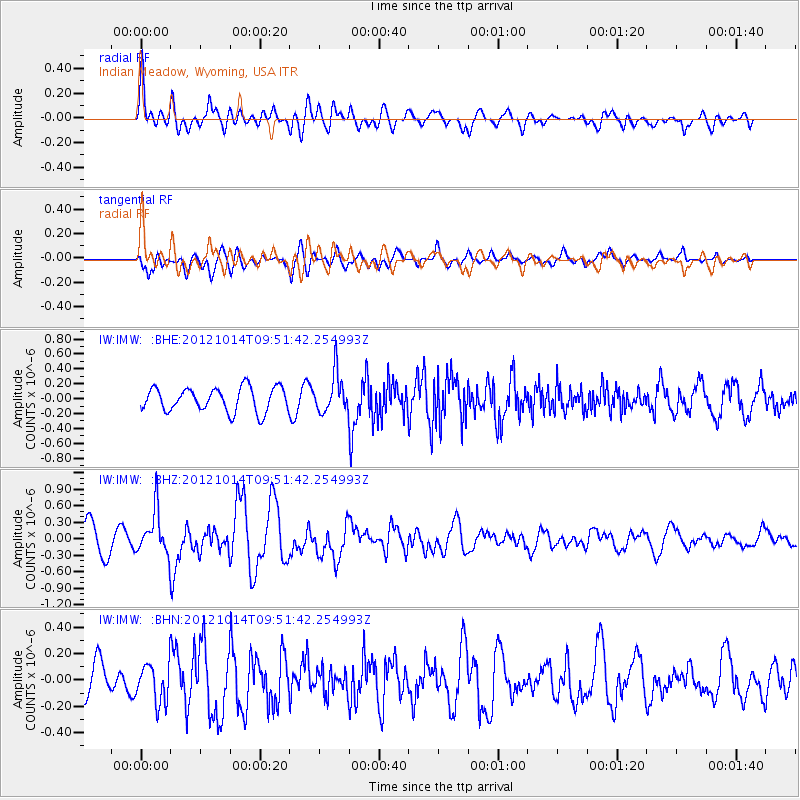
IMW Indian Meadow, Wyoming, USA - Earthquake Result Viewer
*The percent match for this event was below the threshold and hence no stack was calculated.
| Earthquake location: |
Kuril Islands |
| Earthquake latitude/longitude: |
48.3/154.4 |
| Earthquake time(UTC): |
2012/10/14 (288) 09:41:58 GMT |
| Earthquake Depth: |
35 km |
| Earthquake Magnitude: |
5.7 MB, 5.2 MS, 5.7 MW, 5.7 MW |
| Earthquake Catalog/Contributor: |
WHDF/NEIC |
|
| Network: |
IW Intermountain West |
| Station: |
IMW Indian Meadow, Wyoming, USA |
| Lat/Lon: |
43.90 N/110.94 W |
| Elevation: |
2646 m |
|
| Distance: |
61.6 deg |
| Az: |
54.988 deg |
| Baz: |
310.853 deg |
| Ray Param: |
$rayparam |
*The percent match for this event was below the threshold and hence was not used in the summary stack. |
|
| Radial Match: |
61.139805 % |
| Radial Bump: |
400 |
| Transverse Match: |
55.96288 % |
| Transverse Bump: |
400 |
| SOD ConfigId: |
478790 |
| Insert Time: |
2013-02-23 03:45:40.934 +0000 |
| GWidth: |
2.5 |
| Max Bumps: |
400 |
| Tol: |
0.001 |
|
Signal To Noise
| Channel | StoN | STA | LTA |
| IW:IMW: :BHZ:20121014T09:51:42.254993Z | 1.9095296 | 3.972825E-7 | 2.0805254E-7 |
| IW:IMW: :BHN:20121014T09:51:42.254993Z | 1.2207575 | 1.4512331E-7 | 1.1887972E-7 |
| IW:IMW: :BHE:20121014T09:51:42.254993Z | 1.6022099 | 2.567395E-7 | 1.6024086E-7 |
| Arrivals |
| Ps | |
| PpPs | |
| PsPs/PpSs | |


