You are here: Home > Network List > TA - USArray Transportable Network (new EarthScope stations) Stations List
> Station T38A Diamond, MO, USA > Earthquake Result Viewer
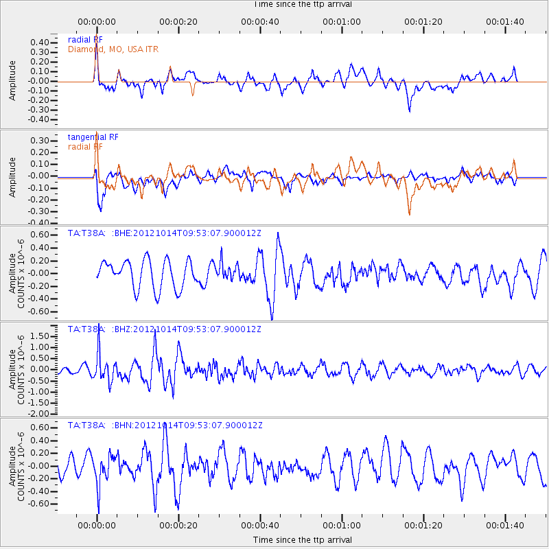
T38A Diamond, MO, USA - Earthquake Result Viewer
*The percent match for this event was below the threshold and hence no stack was calculated.
| Earthquake location: |
Kuril Islands |
| Earthquake latitude/longitude: |
48.3/154.4 |
| Earthquake time(UTC): |
2012/10/14 (288) 09:41:58 GMT |
| Earthquake Depth: |
35 km |
| Earthquake Magnitude: |
5.7 MB, 5.2 MS, 5.7 MW, 5.7 MW |
| Earthquake Catalog/Contributor: |
WHDF/NEIC |
|
| Network: |
TA USArray Transportable Network (new EarthScope stations) |
| Station: |
T38A Diamond, MO, USA |
| Lat/Lon: |
37.04 N/94.29 W |
| Elevation: |
349 m |
|
| Distance: |
75.4 deg |
| Az: |
50.412 deg |
| Baz: |
319.988 deg |
| Ray Param: |
$rayparam |
*The percent match for this event was below the threshold and hence was not used in the summary stack. |
|
| Radial Match: |
65.46785 % |
| Radial Bump: |
400 |
| Transverse Match: |
55.962772 % |
| Transverse Bump: |
400 |
| SOD ConfigId: |
478790 |
| Insert Time: |
2013-02-23 03:52:29.934 +0000 |
| GWidth: |
2.5 |
| Max Bumps: |
400 |
| Tol: |
0.001 |
|
Signal To Noise
| Channel | StoN | STA | LTA |
| TA:T38A: :BHZ:20121014T09:53:07.900012Z | 4.8312874 | 6.4233757E-7 | 1.329537E-7 |
| TA:T38A: :BHN:20121014T09:53:07.900012Z | 1.3928955 | 2.3861682E-7 | 1.7130994E-7 |
| TA:T38A: :BHE:20121014T09:53:07.900012Z | 0.60112524 | 1.298308E-7 | 2.1597961E-7 |
| Arrivals |
| Ps | |
| PpPs | |
| PsPs/PpSs | |


