You are here: Home > Network List > TA - USArray Transportable Network (new EarthScope stations) Stations List
> Station W42A Bald Knob, AR, USA > Earthquake Result Viewer
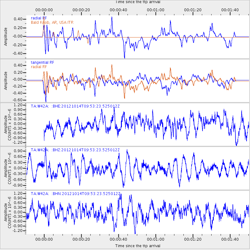
W42A Bald Knob, AR, USA - Earthquake Result Viewer
*The percent match for this event was below the threshold and hence no stack was calculated.
| Earthquake location: |
Kuril Islands |
| Earthquake latitude/longitude: |
48.3/154.4 |
| Earthquake time(UTC): |
2012/10/14 (288) 09:41:58 GMT |
| Earthquake Depth: |
35 km |
| Earthquake Magnitude: |
5.7 MB, 5.2 MS, 5.7 MW, 5.7 MW |
| Earthquake Catalog/Contributor: |
WHDF/NEIC |
|
| Network: |
TA USArray Transportable Network (new EarthScope stations) |
| Station: |
W42A Bald Knob, AR, USA |
| Lat/Lon: |
35.27 N/91.52 W |
| Elevation: |
71 m |
|
| Distance: |
78.1 deg |
| Az: |
49.772 deg |
| Baz: |
321.469 deg |
| Ray Param: |
$rayparam |
*The percent match for this event was below the threshold and hence was not used in the summary stack. |
|
| Radial Match: |
65.34811 % |
| Radial Bump: |
400 |
| Transverse Match: |
55.16158 % |
| Transverse Bump: |
400 |
| SOD ConfigId: |
478790 |
| Insert Time: |
2013-02-23 03:56:27.527 +0000 |
| GWidth: |
2.5 |
| Max Bumps: |
400 |
| Tol: |
0.001 |
|
Signal To Noise
| Channel | StoN | STA | LTA |
| TA:W42A: :BHZ:20121014T09:53:23.525012Z | 1.4468366 | 4.1364066E-7 | 2.8589315E-7 |
| TA:W42A: :BHN:20121014T09:53:23.525012Z | 1.3179172 | 5.196074E-7 | 3.9426405E-7 |
| TA:W42A: :BHE:20121014T09:53:23.525012Z | 1.7395842 | 5.315011E-7 | 3.055334E-7 |
| Arrivals |
| Ps | |
| PpPs | |
| PsPs/PpSs | |


