You are here: Home > Network List > TA - USArray Transportable Network (new EarthScope stations) Stations List
> Station E47A Iron Bridge, ON, CAN > Earthquake Result Viewer
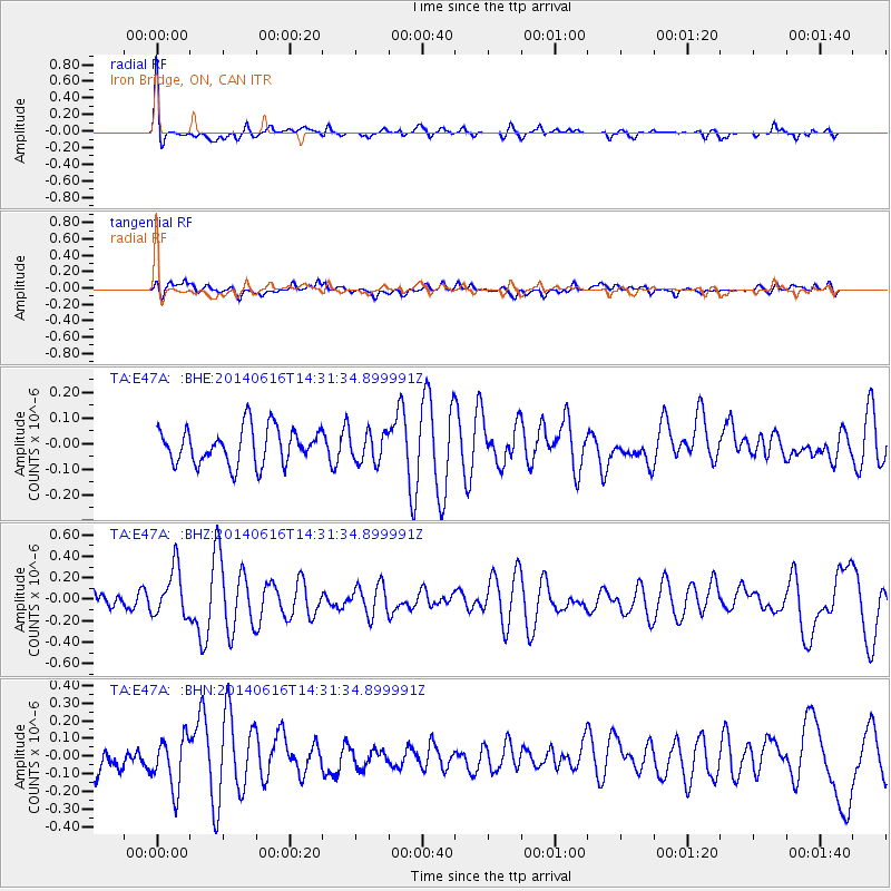
E47A Iron Bridge, ON, CAN - Earthquake Result Viewer
*The percent match for this event was below the threshold and hence no stack was calculated.
| Earthquake location: |
Jan Mayen Island Region |
| Earthquake latitude/longitude: |
70.4/-15.2 |
| Earthquake time(UTC): |
2014/06/16 (167) 14:24:31 GMT |
| Earthquake Depth: |
11 km |
| Earthquake Magnitude: |
5.5 MW |
| Earthquake Catalog/Contributor: |
ISC/ISC |
|
| Network: |
TA USArray Transportable Network (new EarthScope stations) |
| Station: |
E47A Iron Bridge, ON, CAN |
| Lat/Lon: |
46.45 N/83.28 W |
| Elevation: |
246 m |
|
| Distance: |
39.9 deg |
| Az: |
270.118 deg |
| Baz: |
29.257 deg |
| Ray Param: |
$rayparam |
*The percent match for this event was below the threshold and hence was not used in the summary stack. |
|
| Radial Match: |
74.00245 % |
| Radial Bump: |
400 |
| Transverse Match: |
50.859676 % |
| Transverse Bump: |
400 |
| SOD ConfigId: |
3390531 |
| Insert Time: |
2019-04-12 07:53:23.528 +0000 |
| GWidth: |
2.5 |
| Max Bumps: |
400 |
| Tol: |
0.001 |
|
Signal To Noise
| Channel | StoN | STA | LTA |
| TA:E47A: :BHZ:20140616T14:31:34.899991Z | 2.2829614 | 2.2587E-7 | 9.893729E-8 |
| TA:E47A: :BHN:20140616T14:31:34.899991Z | 2.2433424 | 1.419561E-7 | 6.327883E-8 |
| TA:E47A: :BHE:20140616T14:31:34.899991Z | 0.8397767 | 5.916358E-8 | 7.0451556E-8 |
| Arrivals |
| Ps | |
| PpPs | |
| PsPs/PpSs | |


