You are here: Home > Network List > TA - USArray Transportable Network (new EarthScope stations) Stations List
> Station P46A Rosedale, IN, USA > Earthquake Result Viewer
P46A Rosedale, IN, USA - Earthquake Result Viewer
*The percent match for this event was below the threshold and hence no stack was calculated.
| Earthquake location: |
Kuril Islands |
| Earthquake latitude/longitude: |
48.3/154.4 |
| Earthquake time(UTC): |
2012/10/14 (288) 09:41:58 GMT |
| Earthquake Depth: |
35 km |
| Earthquake Magnitude: |
5.7 MB, 5.2 MS, 5.7 MW, 5.7 MW |
| Earthquake Catalog/Contributor: |
WHDF/NEIC |
|
| Network: |
TA USArray Transportable Network (new EarthScope stations) |
| Station: |
P46A Rosedale, IN, USA |
| Lat/Lon: |
39.62 N/87.21 W |
| Elevation: |
194 m |
|
| Distance: |
76.8 deg |
| Az: |
44.27 deg |
| Baz: |
322.891 deg |
| Ray Param: |
$rayparam |
*The percent match for this event was below the threshold and hence was not used in the summary stack. |
|
| Radial Match: |
52.246853 % |
| Radial Bump: |
400 |
| Transverse Match: |
69.80901 % |
| Transverse Bump: |
400 |
| SOD ConfigId: |
478790 |
| Insert Time: |
2013-02-23 03:59:02.557 +0000 |
| GWidth: |
2.5 |
| Max Bumps: |
400 |
| Tol: |
0.001 |
|
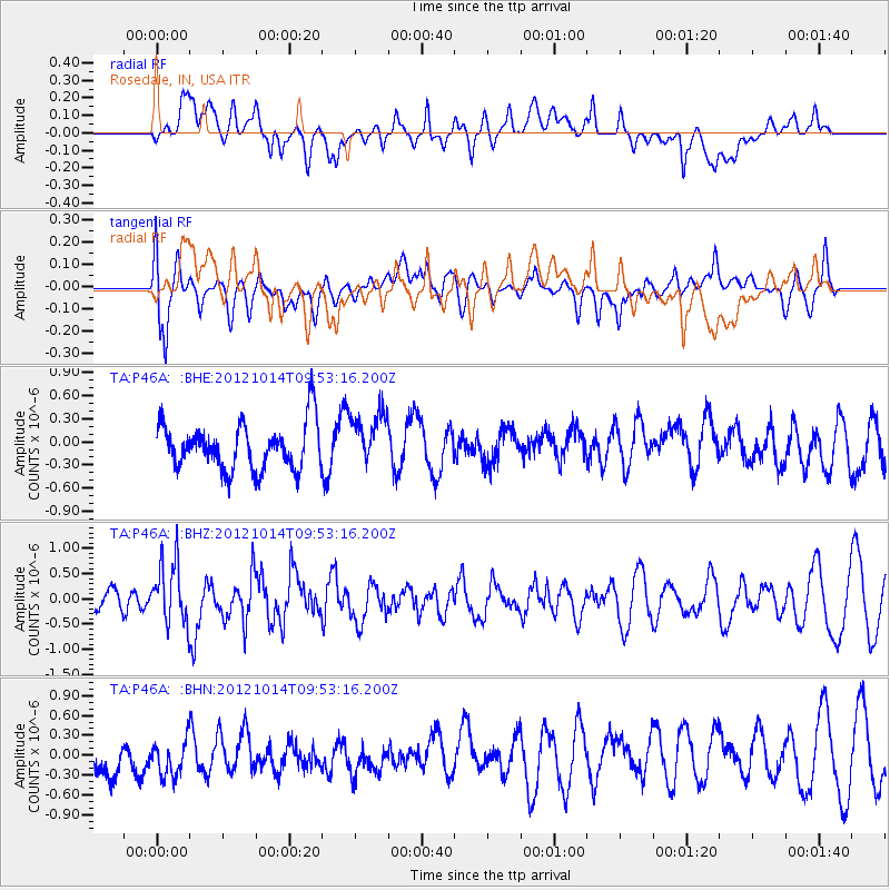
Signal To Noise
| Channel | StoN | STA | LTA |
| TA:P46A: :BHZ:20121014T09:53:16.200Z | 2.0252702 | 6.060488E-7 | 2.9924342E-7 |
| TA:P46A: :BHN:20121014T09:53:16.200Z | 0.97997 | 3.754533E-7 | 3.8312737E-7 |
| TA:P46A: :BHE:20121014T09:53:16.200Z | 1.2031084 | 3.5726742E-7 | 2.9695363E-7 |
| Arrivals |
| Ps | |
| PpPs | |
| PsPs/PpSs | |


