You are here: Home > Network List > TA - USArray Transportable Network (new EarthScope stations) Stations List
> Station S42A Caledonia, MO, USA > Earthquake Result Viewer
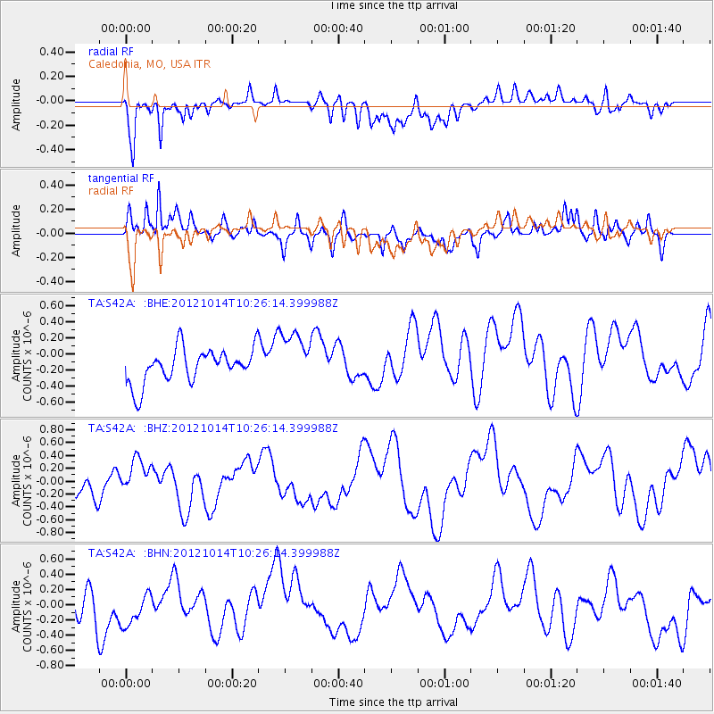
S42A Caledonia, MO, USA - Earthquake Result Viewer
*The percent match for this event was below the threshold and hence no stack was calculated.
| Earthquake location: |
Eastern Caucasus |
| Earthquake latitude/longitude: |
41.8/46.4 |
| Earthquake time(UTC): |
2012/10/14 (288) 10:13:38 GMT |
| Earthquake Depth: |
10 km |
| Earthquake Magnitude: |
5.5 MW, 5.4 MS, 5.3 MB, 5.6 ML |
| Earthquake Catalog/Contributor: |
WHDF/NEIC |
|
| Network: |
TA USArray Transportable Network (new EarthScope stations) |
| Station: |
S42A Caledonia, MO, USA |
| Lat/Lon: |
37.77 N/90.79 W |
| Elevation: |
315 m |
|
| Distance: |
91.7 deg |
| Az: |
327.407 deg |
| Baz: |
30.534 deg |
| Ray Param: |
$rayparam |
*The percent match for this event was below the threshold and hence was not used in the summary stack. |
|
| Radial Match: |
62.265545 % |
| Radial Bump: |
400 |
| Transverse Match: |
61.29935 % |
| Transverse Bump: |
400 |
| SOD ConfigId: |
478790 |
| Insert Time: |
2013-02-23 04:11:12.666 +0000 |
| GWidth: |
2.5 |
| Max Bumps: |
400 |
| Tol: |
0.001 |
|
Signal To Noise
| Channel | StoN | STA | LTA |
| TA:S42A: :BHZ:20121014T10:26:14.399988Z | 1.4592428 | 2.8409804E-7 | 1.9468867E-7 |
| TA:S42A: :BHN:20121014T10:26:14.399988Z | 0.54992783 | 1.9361863E-7 | 3.5208006E-7 |
| TA:S42A: :BHE:20121014T10:26:14.399988Z | 1.5560402 | 3.2963902E-7 | 2.118448E-7 |
| Arrivals |
| Ps | |
| PpPs | |
| PsPs/PpSs | |


