You are here: Home > Network List > TA - USArray Transportable Network (new EarthScope stations) Stations List
> Station F39A Loretta, WI, USA > Earthquake Result Viewer
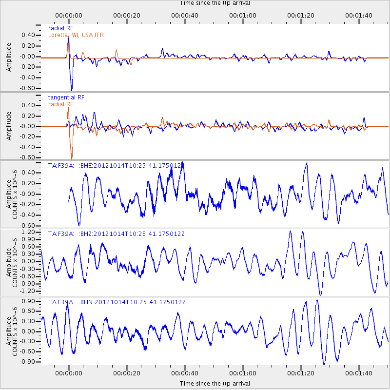
F39A Loretta, WI, USA - Earthquake Result Viewer
*The percent match for this event was below the threshold and hence no stack was calculated.
| Earthquake location: |
Eastern Caucasus |
| Earthquake latitude/longitude: |
41.8/46.4 |
| Earthquake time(UTC): |
2012/10/14 (288) 10:13:38 GMT |
| Earthquake Depth: |
10 km |
| Earthquake Magnitude: |
5.5 MW, 5.4 MS, 5.3 MB, 5.6 ML |
| Earthquake Catalog/Contributor: |
WHDF/NEIC |
|
| Network: |
TA USArray Transportable Network (new EarthScope stations) |
| Station: |
F39A Loretta, WI, USA |
| Lat/Lon: |
45.92 N/90.92 W |
| Elevation: |
440 m |
|
| Distance: |
84.7 deg |
| Az: |
331.625 deg |
| Baz: |
30.583 deg |
| Ray Param: |
$rayparam |
*The percent match for this event was below the threshold and hence was not used in the summary stack. |
|
| Radial Match: |
86.156105 % |
| Radial Bump: |
400 |
| Transverse Match: |
66.450485 % |
| Transverse Bump: |
400 |
| SOD ConfigId: |
478790 |
| Insert Time: |
2013-02-23 04:11:36.630 +0000 |
| GWidth: |
2.5 |
| Max Bumps: |
400 |
| Tol: |
0.001 |
|
Signal To Noise
| Channel | StoN | STA | LTA |
| TA:F39A: :BHZ:20121014T10:25:41.175012Z | 1.3347298 | 4.5360645E-7 | 3.398489E-7 |
| TA:F39A: :BHN:20121014T10:25:41.175012Z | 2.1756344 | 4.9126515E-7 | 2.2580316E-7 |
| TA:F39A: :BHE:20121014T10:25:41.175012Z | 1.2254621 | 2.611086E-7 | 2.1306951E-7 |
| Arrivals |
| Ps | |
| PpPs | |
| PsPs/PpSs | |


