You are here: Home > Network List > TA - USArray Transportable Network (new EarthScope stations) Stations List
> Station E43A Lone Tree Farm, Eben Junction, MI, USA > Earthquake Result Viewer
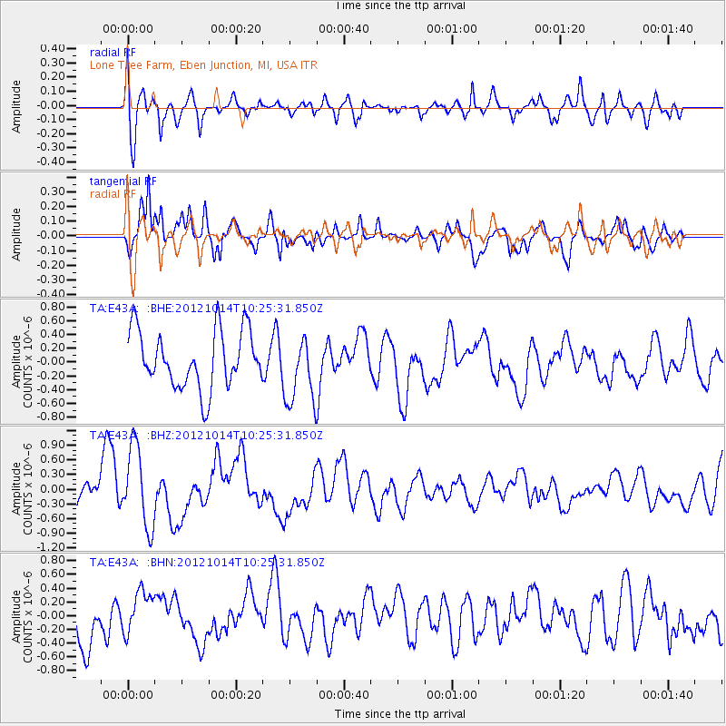
E43A Lone Tree Farm, Eben Junction, MI, USA - Earthquake Result Viewer
*The percent match for this event was below the threshold and hence no stack was calculated.
| Earthquake location: |
Eastern Caucasus |
| Earthquake latitude/longitude: |
41.8/46.4 |
| Earthquake time(UTC): |
2012/10/14 (288) 10:13:38 GMT |
| Earthquake Depth: |
10 km |
| Earthquake Magnitude: |
5.5 MW, 5.4 MS, 5.3 MB, 5.6 ML |
| Earthquake Catalog/Contributor: |
WHDF/NEIC |
|
| Network: |
TA USArray Transportable Network (new EarthScope stations) |
| Station: |
E43A Lone Tree Farm, Eben Junction, MI, USA |
| Lat/Lon: |
46.38 N/87.00 W |
| Elevation: |
303 m |
|
| Distance: |
82.9 deg |
| Az: |
329.54 deg |
| Baz: |
33.179 deg |
| Ray Param: |
$rayparam |
*The percent match for this event was below the threshold and hence was not used in the summary stack. |
|
| Radial Match: |
72.44759 % |
| Radial Bump: |
400 |
| Transverse Match: |
62.661575 % |
| Transverse Bump: |
400 |
| SOD ConfigId: |
478790 |
| Insert Time: |
2013-02-23 04:11:38.301 +0000 |
| GWidth: |
2.5 |
| Max Bumps: |
400 |
| Tol: |
0.001 |
|
Signal To Noise
| Channel | StoN | STA | LTA |
| TA:E43A: :BHZ:20121014T10:25:31.850Z | 2.2330568 | 8.334987E-7 | 3.7325458E-7 |
| TA:E43A: :BHN:20121014T10:25:31.850Z | 0.99201345 | 3.2629498E-7 | 3.2892194E-7 |
| TA:E43A: :BHE:20121014T10:25:31.850Z | 1.2027186 | 4.980684E-7 | 4.141188E-7 |
| Arrivals |
| Ps | |
| PpPs | |
| PsPs/PpSs | |


