You are here: Home > Network List > CI - Caltech Regional Seismic Network Stations List
> Station BFS Mt Baldy Forest Station > Earthquake Result Viewer
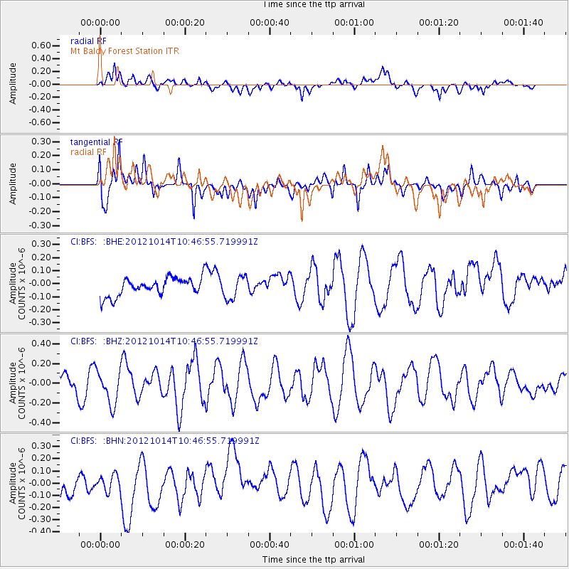
BFS Mt Baldy Forest Station - Earthquake Result Viewer
*The percent match for this event was below the threshold and hence no stack was calculated.
| Earthquake location: |
Near Coast Of Chiapas, Mexico |
| Earthquake latitude/longitude: |
14.7/-92.3 |
| Earthquake time(UTC): |
2012/10/14 (288) 10:41:23 GMT |
| Earthquake Depth: |
69 km |
| Earthquake Magnitude: |
5.5 MW, 5.4 MB, 5.2 MD |
| Earthquake Catalog/Contributor: |
WHDF/NEIC |
|
| Network: |
CI Caltech Regional Seismic Network |
| Station: |
BFS Mt Baldy Forest Station |
| Lat/Lon: |
34.24 N/117.66 W |
| Elevation: |
1312 m |
|
| Distance: |
30.1 deg |
| Az: |
314.878 deg |
| Baz: |
124.13 deg |
| Ray Param: |
$rayparam |
*The percent match for this event was below the threshold and hence was not used in the summary stack. |
|
| Radial Match: |
58.71183 % |
| Radial Bump: |
400 |
| Transverse Match: |
64.19302 % |
| Transverse Bump: |
400 |
| SOD ConfigId: |
478790 |
| Insert Time: |
2013-02-23 04:16:27.890 +0000 |
| GWidth: |
2.5 |
| Max Bumps: |
400 |
| Tol: |
0.001 |
|
Signal To Noise
| Channel | StoN | STA | LTA |
| CI:BFS: :BHZ:20121014T10:46:55.719991Z | 1.2979914 | 1.7365457E-7 | 1.3378714E-7 |
| CI:BFS: :BHN:20121014T10:46:55.719991Z | 0.59364736 | 8.0364195E-8 | 1.3537363E-7 |
| CI:BFS: :BHE:20121014T10:46:55.719991Z | 1.2691948 | 8.815913E-8 | 6.9460675E-8 |
| Arrivals |
| Ps | |
| PpPs | |
| PsPs/PpSs | |


