You are here: Home > Network List > UW - Pacific Northwest Regional Seismic Network Stations List
> Station HOOD Mt Hood Meadows, OR CREST BB SMO > Earthquake Result Viewer
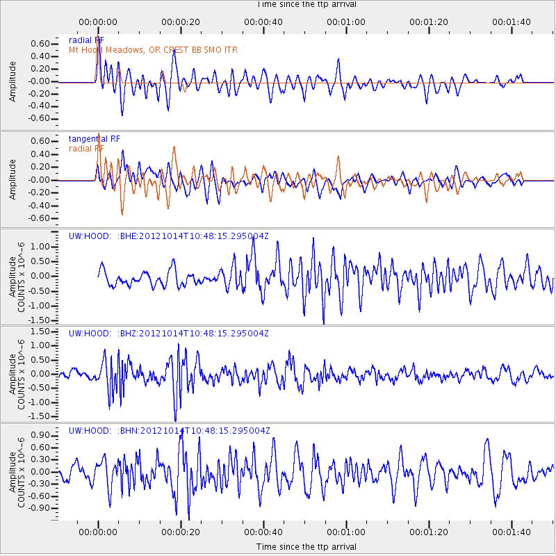
HOOD Mt Hood Meadows, OR CREST BB SMO - Earthquake Result Viewer
*The percent match for this event was below the threshold and hence no stack was calculated.
| Earthquake location: |
Near Coast Of Chiapas, Mexico |
| Earthquake latitude/longitude: |
14.7/-92.3 |
| Earthquake time(UTC): |
2012/10/14 (288) 10:41:23 GMT |
| Earthquake Depth: |
69 km |
| Earthquake Magnitude: |
5.5 MW, 5.4 MB, 5.2 MD |
| Earthquake Catalog/Contributor: |
WHDF/NEIC |
|
| Network: |
UW Pacific Northwest Regional Seismic Network |
| Station: |
HOOD Mt Hood Meadows, OR CREST BB SMO |
| Lat/Lon: |
45.32 N/121.65 W |
| Elevation: |
1520 m |
|
| Distance: |
39.3 deg |
| Az: |
326.913 deg |
| Baz: |
131.511 deg |
| Ray Param: |
$rayparam |
*The percent match for this event was below the threshold and hence was not used in the summary stack. |
|
| Radial Match: |
56.325283 % |
| Radial Bump: |
400 |
| Transverse Match: |
67.66455 % |
| Transverse Bump: |
400 |
| SOD ConfigId: |
478790 |
| Insert Time: |
2013-02-23 04:19:39.009 +0000 |
| GWidth: |
2.5 |
| Max Bumps: |
400 |
| Tol: |
0.001 |
|
Signal To Noise
| Channel | StoN | STA | LTA |
| UW:HOOD: :BHZ:20121014T10:48:15.295004Z | 3.356952 | 5.0976047E-7 | 1.5185218E-7 |
| UW:HOOD: :BHN:20121014T10:48:15.295004Z | 1.7139437 | 3.433144E-7 | 2.0030669E-7 |
| UW:HOOD: :BHE:20121014T10:48:15.295004Z | 1.4736415 | 3.4990612E-7 | 2.3744317E-7 |
| Arrivals |
| Ps | |
| PpPs | |
| PsPs/PpSs | |


