You are here: Home > Network List > TA - USArray Transportable Network (new EarthScope stations) Stations List
> Station Y59A Loris, SC, USA > Earthquake Result Viewer
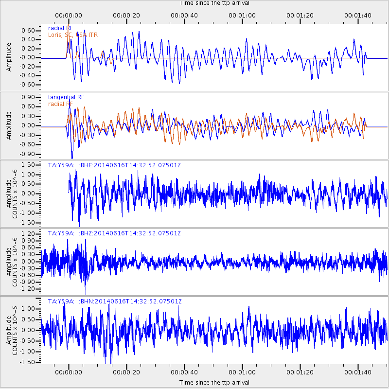
Y59A Loris, SC, USA - Earthquake Result Viewer
*The percent match for this event was below the threshold and hence no stack was calculated.
| Earthquake location: |
Jan Mayen Island Region |
| Earthquake latitude/longitude: |
70.4/-15.2 |
| Earthquake time(UTC): |
2014/06/16 (167) 14:24:31 GMT |
| Earthquake Depth: |
11 km |
| Earthquake Magnitude: |
5.5 MW |
| Earthquake Catalog/Contributor: |
ISC/ISC |
|
| Network: |
TA USArray Transportable Network (new EarthScope stations) |
| Station: |
Y59A Loris, SC, USA |
| Lat/Lon: |
33.99 N/78.87 W |
| Elevation: |
2.0 m |
|
| Distance: |
49.6 deg |
| Az: |
257.976 deg |
| Baz: |
23.437 deg |
| Ray Param: |
$rayparam |
*The percent match for this event was below the threshold and hence was not used in the summary stack. |
|
| Radial Match: |
60.9868 % |
| Radial Bump: |
400 |
| Transverse Match: |
55.202763 % |
| Transverse Bump: |
400 |
| SOD ConfigId: |
3390531 |
| Insert Time: |
2019-04-12 07:55:14.653 +0000 |
| GWidth: |
2.5 |
| Max Bumps: |
400 |
| Tol: |
0.001 |
|
Signal To Noise
| Channel | StoN | STA | LTA |
| TA:Y59A: :BHZ:20140616T14:32:52.07501Z | 1.6358085 | 4.0402435E-7 | 2.4698755E-7 |
| TA:Y59A: :BHN:20140616T14:32:52.07501Z | 0.8331575 | 3.8129738E-7 | 4.5765344E-7 |
| TA:Y59A: :BHE:20140616T14:32:52.07501Z | 0.8541155 | 4.690265E-7 | 5.491371E-7 |
| Arrivals |
| Ps | |
| PpPs | |
| PsPs/PpSs | |


