You are here: Home > Network List > TA - USArray Transportable Network (new EarthScope stations) Stations List
> Station S44A Carbondale, IL, USA > Earthquake Result Viewer
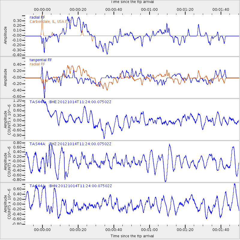
S44A Carbondale, IL, USA - Earthquake Result Viewer
*The percent match for this event was below the threshold and hence no stack was calculated.
| Earthquake location: |
Off East Coast Of Honshu, Japan |
| Earthquake latitude/longitude: |
38.2/144.3 |
| Earthquake time(UTC): |
2012/10/14 (288) 11:11:36 GMT |
| Earthquake Depth: |
34 km |
| Earthquake Magnitude: |
5.6 MB, 4.9 MS, 5.4 MW |
| Earthquake Catalog/Contributor: |
WHDF/NEIC |
|
| Network: |
TA USArray Transportable Network (new EarthScope stations) |
| Station: |
S44A Carbondale, IL, USA |
| Lat/Lon: |
37.69 N/89.26 W |
| Elevation: |
155 m |
|
| Distance: |
89.8 deg |
| Az: |
39.673 deg |
| Baz: |
320.659 deg |
| Ray Param: |
$rayparam |
*The percent match for this event was below the threshold and hence was not used in the summary stack. |
|
| Radial Match: |
37.76008 % |
| Radial Bump: |
400 |
| Transverse Match: |
49.889038 % |
| Transverse Bump: |
400 |
| SOD ConfigId: |
478790 |
| Insert Time: |
2013-02-23 04:34:49.117 +0000 |
| GWidth: |
2.5 |
| Max Bumps: |
400 |
| Tol: |
0.001 |
|
Signal To Noise
| Channel | StoN | STA | LTA |
| TA:S44A: :BHZ:20121014T11:24:00.07502Z | 1.6838849 | 2.8877147E-7 | 1.7149122E-7 |
| TA:S44A: :BHN:20121014T11:24:00.07502Z | 1.9455124 | 4.3472264E-7 | 2.2344891E-7 |
| TA:S44A: :BHE:20121014T11:24:00.07502Z | 2.1293964 | 7.9091234E-7 | 3.7142559E-7 |
| Arrivals |
| Ps | |
| PpPs | |
| PsPs/PpSs | |


