You are here: Home > Network List > CI - Caltech Regional Seismic Network Stations List
> Station MPM Manuel Prospect Mine, California, USA > Earthquake Result Viewer
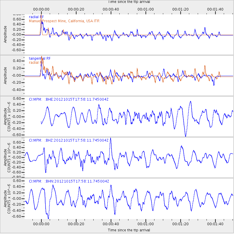
MPM Manuel Prospect Mine, California, USA - Earthquake Result Viewer
*The percent match for this event was below the threshold and hence no stack was calculated.
| Earthquake location: |
Guatemala |
| Earthquake latitude/longitude: |
14.1/-91.0 |
| Earthquake time(UTC): |
2012/10/15 (289) 17:52:20 GMT |
| Earthquake Depth: |
82 km |
| Earthquake Magnitude: |
5.5 MW, 5.4 MB, 5.5 MW |
| Earthquake Catalog/Contributor: |
WHDF/NEIC |
|
| Network: |
CI Caltech Regional Seismic Network |
| Station: |
MPM Manuel Prospect Mine, California, USA |
| Lat/Lon: |
36.06 N/117.49 W |
| Elevation: |
185 m |
|
| Distance: |
32.3 deg |
| Az: |
317.449 deg |
| Baz: |
125.916 deg |
| Ray Param: |
$rayparam |
*The percent match for this event was below the threshold and hence was not used in the summary stack. |
|
| Radial Match: |
59.200325 % |
| Radial Bump: |
400 |
| Transverse Match: |
53.99658 % |
| Transverse Bump: |
358 |
| SOD ConfigId: |
478790 |
| Insert Time: |
2013-02-23 04:43:17.896 +0000 |
| GWidth: |
2.5 |
| Max Bumps: |
400 |
| Tol: |
0.001 |
|
Signal To Noise
| Channel | StoN | STA | LTA |
| CI:MPM: :BHZ:20121015T17:58:11.745004Z | 1.6078179 | 2.6426125E-7 | 1.6436019E-7 |
| CI:MPM: :BHN:20121015T17:58:11.745004Z | 3.188142 | 3.8577954E-7 | 1.210045E-7 |
| CI:MPM: :BHE:20121015T17:58:11.745004Z | 1.2176847 | 2.1660246E-7 | 1.7788057E-7 |
| Arrivals |
| Ps | |
| PpPs | |
| PsPs/PpSs | |


