You are here: Home > Network List > TA - USArray Transportable Network (new EarthScope stations) Stations List
> Station H17A Grant Village (NPS), Yellowstone Nt. Park, WY, USA > Earthquake Result Viewer
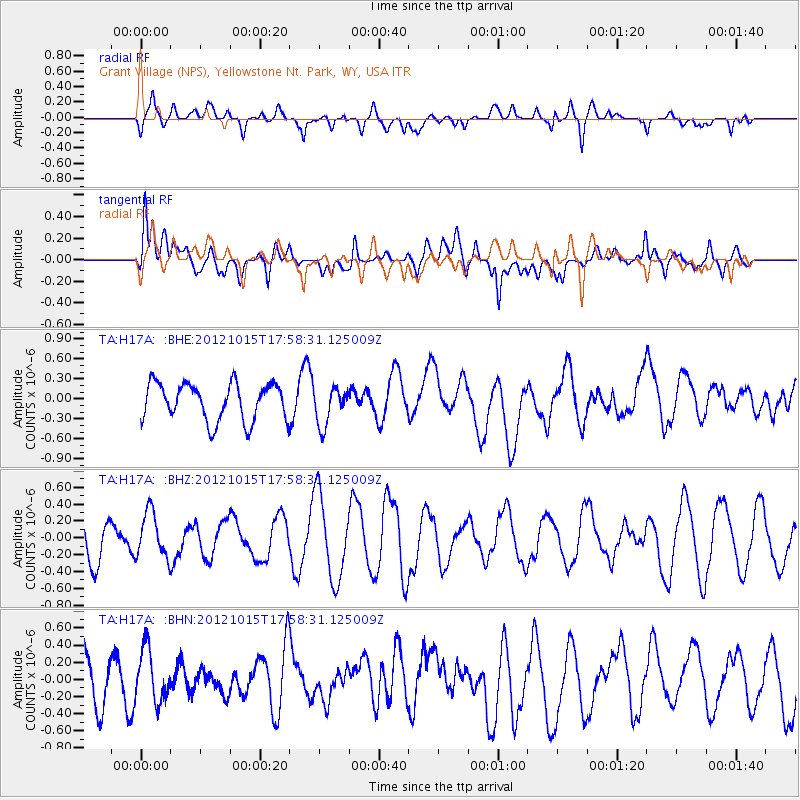
H17A Grant Village (NPS), Yellowstone Nt. Park, WY, USA - Earthquake Result Viewer
*The percent match for this event was below the threshold and hence no stack was calculated.
| Earthquake location: |
Guatemala |
| Earthquake latitude/longitude: |
14.1/-91.0 |
| Earthquake time(UTC): |
2012/10/15 (289) 17:52:20 GMT |
| Earthquake Depth: |
82 km |
| Earthquake Magnitude: |
5.5 MW, 5.4 MB, 5.5 MW |
| Earthquake Catalog/Contributor: |
WHDF/NEIC |
|
| Network: |
TA USArray Transportable Network (new EarthScope stations) |
| Station: |
H17A Grant Village (NPS), Yellowstone Nt. Park, WY, USA |
| Lat/Lon: |
44.40 N/110.58 W |
| Elevation: |
2400 m |
|
| Distance: |
34.5 deg |
| Az: |
334.942 deg |
| Baz: |
145.017 deg |
| Ray Param: |
$rayparam |
*The percent match for this event was below the threshold and hence was not used in the summary stack. |
|
| Radial Match: |
52.81982 % |
| Radial Bump: |
400 |
| Transverse Match: |
56.069946 % |
| Transverse Bump: |
400 |
| SOD ConfigId: |
478790 |
| Insert Time: |
2013-02-23 04:45:34.535 +0000 |
| GWidth: |
2.5 |
| Max Bumps: |
400 |
| Tol: |
0.001 |
|
Signal To Noise
| Channel | StoN | STA | LTA |
| TA:H17A: :BHZ:20121015T17:58:31.125009Z | 0.6847248 | 2.671733E-7 | 3.9019076E-7 |
| TA:H17A: :BHN:20121015T17:58:31.125009Z | 0.7035625 | 2.9945923E-7 | 4.2563272E-7 |
| TA:H17A: :BHE:20121015T17:58:31.125009Z | 1.0200621 | 2.8505508E-7 | 2.7944876E-7 |
| Arrivals |
| Ps | |
| PpPs | |
| PsPs/PpSs | |


