You are here: Home > Network List > AZ - ANZA Regional Network Stations List
> Station SMER AZ.SMER > Earthquake Result Viewer
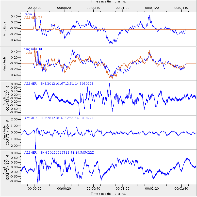
SMER AZ.SMER - Earthquake Result Viewer
*The percent match for this event was below the threshold and hence no stack was calculated.
| Earthquake location: |
Kuril Islands |
| Earthquake latitude/longitude: |
49.6/156.4 |
| Earthquake time(UTC): |
2012/10/16 (290) 12:41:25 GMT |
| Earthquake Depth: |
81 km |
| Earthquake Magnitude: |
6.2 MB, 5.6 MW, 5.6 MW |
| Earthquake Catalog/Contributor: |
WHDF/NEIC |
|
| Network: |
AZ ANZA Regional Network |
| Station: |
SMER AZ.SMER |
| Lat/Lon: |
33.46 N/117.17 W |
| Elevation: |
355 m |
|
| Distance: |
63.2 deg |
| Az: |
69.2 deg |
| Baz: |
313.34 deg |
| Ray Param: |
$rayparam |
*The percent match for this event was below the threshold and hence was not used in the summary stack. |
|
| Radial Match: |
52.415524 % |
| Radial Bump: |
400 |
| Transverse Match: |
50.527725 % |
| Transverse Bump: |
400 |
| SOD ConfigId: |
478790 |
| Insert Time: |
2013-02-23 04:51:31.606 +0000 |
| GWidth: |
2.5 |
| Max Bumps: |
400 |
| Tol: |
0.001 |
|
Signal To Noise
| Channel | StoN | STA | LTA |
| AZ:SMER: :BHZ:20121016T12:51:14.595022Z | 3.6553319 | 6.967283E-7 | 1.9060603E-7 |
| AZ:SMER: :BHN:20121016T12:51:14.595022Z | 1.8197726 | 5.0103944E-7 | 2.753308E-7 |
| AZ:SMER: :BHE:20121016T12:51:14.595022Z | 2.033421 | 3.8331834E-7 | 1.8850908E-7 |
| Arrivals |
| Ps | |
| PpPs | |
| PsPs/PpSs | |


