You are here: Home > Network List > BK - Berkeley Digital Seismograph Network Stations List
> Station SAO San Andreas Geophysical Obs., Hollister, CA, USA > Earthquake Result Viewer
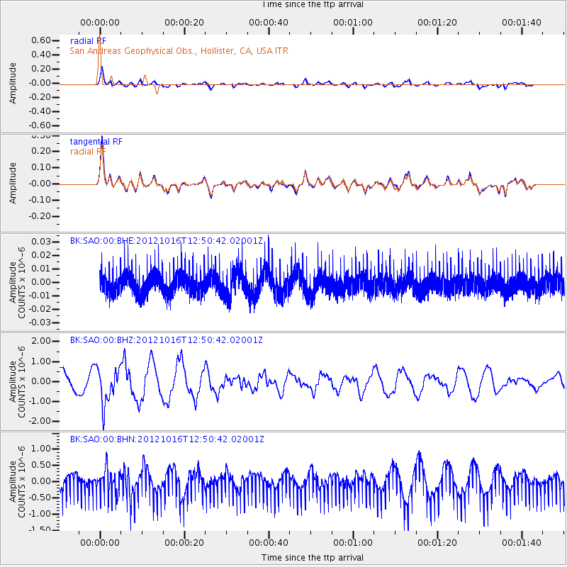
SAO San Andreas Geophysical Obs., Hollister, CA, USA - Earthquake Result Viewer
*The percent match for this event was below the threshold and hence no stack was calculated.
| Earthquake location: |
Kuril Islands |
| Earthquake latitude/longitude: |
49.6/156.4 |
| Earthquake time(UTC): |
2012/10/16 (290) 12:41:25 GMT |
| Earthquake Depth: |
81 km |
| Earthquake Magnitude: |
6.2 MB, 5.6 MW, 5.6 MW |
| Earthquake Catalog/Contributor: |
WHDF/NEIC |
|
| Network: |
BK Berkeley Digital Seismograph Network |
| Station: |
SAO San Andreas Geophysical Obs., Hollister, CA, USA |
| Lat/Lon: |
36.76 N/121.45 W |
| Elevation: |
317 m |
|
| Distance: |
58.4 deg |
| Az: |
69.089 deg |
| Baz: |
310.835 deg |
| Ray Param: |
$rayparam |
*The percent match for this event was below the threshold and hence was not used in the summary stack. |
|
| Radial Match: |
58.535282 % |
| Radial Bump: |
400 |
| Transverse Match: |
59.337692 % |
| Transverse Bump: |
400 |
| SOD ConfigId: |
478790 |
| Insert Time: |
2013-02-23 04:51:44.546 +0000 |
| GWidth: |
2.5 |
| Max Bumps: |
400 |
| Tol: |
0.001 |
|
Signal To Noise
| Channel | StoN | STA | LTA |
| BK:SAO:00:BHZ:20121016T12:50:42.02001Z | 1.9258988 | 8.7840783E-7 | 4.561028E-7 |
| BK:SAO:00:BHN:20121016T12:50:42.02001Z | 1.0621771 | 3.981686E-7 | 3.7486086E-7 |
| BK:SAO:00:BHE:20121016T12:50:42.02001Z | 1.2417561 | 1.0556224E-8 | 8.501045E-9 |
| Arrivals |
| Ps | |
| PpPs | |
| PsPs/PpSs | |


