You are here: Home > Network List > CI - Caltech Regional Seismic Network Stations List
> Station SHO Shoshone, CA, USA > Earthquake Result Viewer
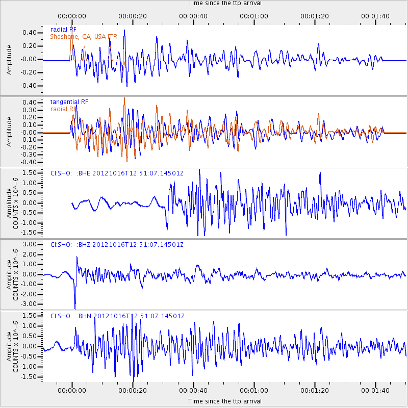
SHO Shoshone, CA, USA - Earthquake Result Viewer
*The percent match for this event was below the threshold and hence no stack was calculated.
| Earthquake location: |
Kuril Islands |
| Earthquake latitude/longitude: |
49.6/156.4 |
| Earthquake time(UTC): |
2012/10/16 (290) 12:41:25 GMT |
| Earthquake Depth: |
81 km |
| Earthquake Magnitude: |
6.2 MB, 5.6 MW, 5.6 MW |
| Earthquake Catalog/Contributor: |
WHDF/NEIC |
|
| Network: |
CI Caltech Regional Seismic Network |
| Station: |
SHO Shoshone, CA, USA |
| Lat/Lon: |
35.90 N/116.28 W |
| Elevation: |
451 m |
|
| Distance: |
62.1 deg |
| Az: |
66.627 deg |
| Baz: |
312.664 deg |
| Ray Param: |
$rayparam |
*The percent match for this event was below the threshold and hence was not used in the summary stack. |
|
| Radial Match: |
66.735825 % |
| Radial Bump: |
400 |
| Transverse Match: |
82.79002 % |
| Transverse Bump: |
400 |
| SOD ConfigId: |
478790 |
| Insert Time: |
2013-02-23 04:54:21.306 +0000 |
| GWidth: |
2.5 |
| Max Bumps: |
400 |
| Tol: |
0.001 |
|
Signal To Noise
| Channel | StoN | STA | LTA |
| CI:SHO: :BHZ:20121016T12:51:07.14501Z | 8.004445 | 1.0261499E-6 | 1.281975E-7 |
| CI:SHO: :BHN:20121016T12:51:07.14501Z | 2.756621 | 3.1245875E-7 | 1.1334847E-7 |
| CI:SHO: :BHE:20121016T12:51:07.14501Z | 3.8101087 | 5.813749E-7 | 1.5258749E-7 |
| Arrivals |
| Ps | |
| PpPs | |
| PsPs/PpSs | |


