You are here: Home > Network List > IW - Intermountain West Stations List
> Station MOOW Moose Ponds, Wyoming, USA > Earthquake Result Viewer
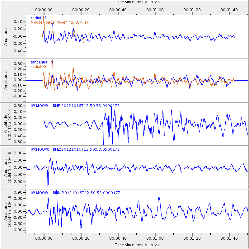
MOOW Moose Ponds, Wyoming, USA - Earthquake Result Viewer
*The percent match for this event was below the threshold and hence no stack was calculated.
| Earthquake location: |
Kuril Islands |
| Earthquake latitude/longitude: |
49.6/156.4 |
| Earthquake time(UTC): |
2012/10/16 (290) 12:41:25 GMT |
| Earthquake Depth: |
81 km |
| Earthquake Magnitude: |
6.2 MB, 5.6 MW, 5.6 MW |
| Earthquake Catalog/Contributor: |
WHDF/NEIC |
|
| Network: |
IW Intermountain West |
| Station: |
MOOW Moose Ponds, Wyoming, USA |
| Lat/Lon: |
43.75 N/110.74 W |
| Elevation: |
2128 m |
|
| Distance: |
60.0 deg |
| Az: |
56.713 deg |
| Baz: |
311.389 deg |
| Ray Param: |
$rayparam |
*The percent match for this event was below the threshold and hence was not used in the summary stack. |
|
| Radial Match: |
69.80469 % |
| Radial Bump: |
400 |
| Transverse Match: |
53.639027 % |
| Transverse Bump: |
400 |
| SOD ConfigId: |
478790 |
| Insert Time: |
2013-02-23 05:00:54.929 +0000 |
| GWidth: |
2.5 |
| Max Bumps: |
400 |
| Tol: |
0.001 |
|
Signal To Noise
| Channel | StoN | STA | LTA |
| IW:MOOW: :BHZ:20121016T12:50:53.090017Z | 5.237956 | 8.5755875E-7 | 1.637201E-7 |
| IW:MOOW: :BHN:20121016T12:50:53.090017Z | 2.3325274 | 3.0766503E-7 | 1.3190201E-7 |
| IW:MOOW: :BHE:20121016T12:50:53.090017Z | 3.7940502 | 2.2612727E-7 | 5.9600495E-8 |
| Arrivals |
| Ps | |
| PpPs | |
| PsPs/PpSs | |


