You are here: Home > Network List > NM - Cooperative New Madrid Seismic Network Stations List
> Station UTMT Martin, TN > Earthquake Result Viewer
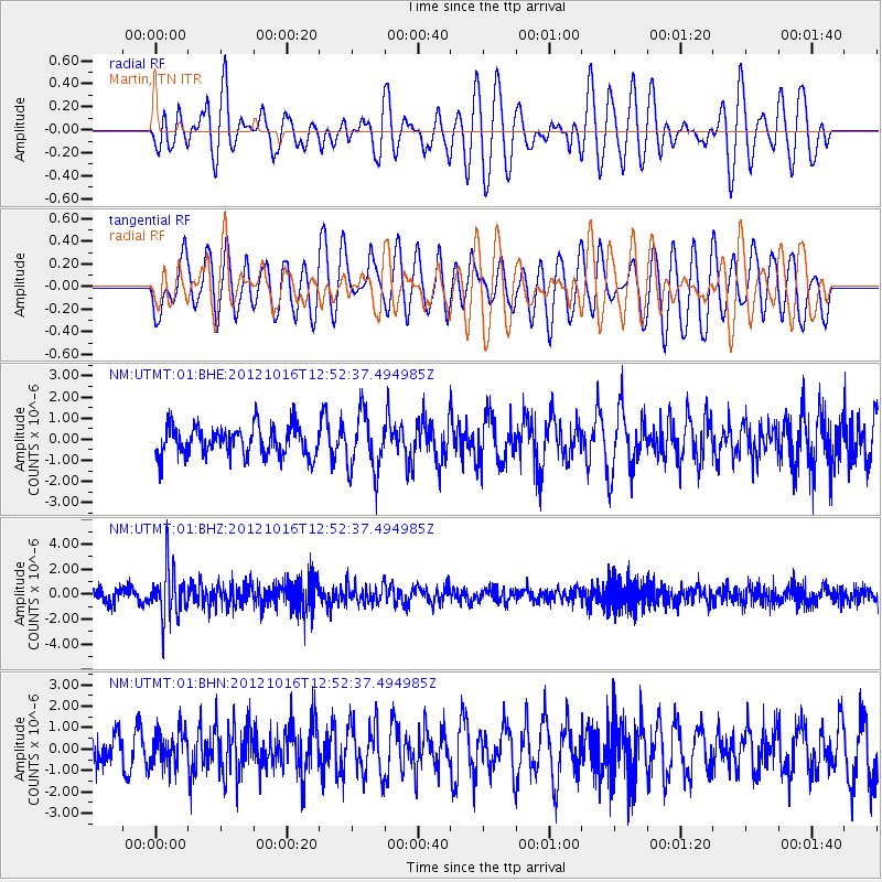
UTMT Martin, TN - Earthquake Result Viewer
*The percent match for this event was below the threshold and hence no stack was calculated.
| Earthquake location: |
Kuril Islands |
| Earthquake latitude/longitude: |
49.6/156.4 |
| Earthquake time(UTC): |
2012/10/16 (290) 12:41:25 GMT |
| Earthquake Depth: |
81 km |
| Earthquake Magnitude: |
6.2 MB, 5.6 MW, 5.6 MW |
| Earthquake Catalog/Contributor: |
WHDF/NEIC |
|
| Network: |
NM Cooperative New Madrid Seismic Network |
| Station: |
UTMT Martin, TN |
| Lat/Lon: |
36.35 N/88.86 W |
| Elevation: |
110 m |
|
| Distance: |
76.8 deg |
| Az: |
48.89 deg |
| Baz: |
322.626 deg |
| Ray Param: |
$rayparam |
*The percent match for this event was below the threshold and hence was not used in the summary stack. |
|
| Radial Match: |
50.680687 % |
| Radial Bump: |
400 |
| Transverse Match: |
50.676746 % |
| Transverse Bump: |
400 |
| SOD ConfigId: |
478790 |
| Insert Time: |
2013-02-23 05:07:36.949 +0000 |
| GWidth: |
2.5 |
| Max Bumps: |
400 |
| Tol: |
0.001 |
|
Signal To Noise
| Channel | StoN | STA | LTA |
| NM:UTMT:01:BHZ:20121016T12:52:37.494985Z | 3.7655997 | 2.0164298E-6 | 5.35487E-7 |
| NM:UTMT:01:BHN:20121016T12:52:37.494985Z | 0.79063183 | 7.9371586E-7 | 1.0039007E-6 |
| NM:UTMT:01:BHE:20121016T12:52:37.494985Z | 1.9298924 | 1.3596815E-6 | 7.0453746E-7 |
| Arrivals |
| Ps | |
| PpPs | |
| PsPs/PpSs | |


