You are here: Home > Network List > TA - USArray Transportable Network (new EarthScope stations) Stations List
> Station SFIN Lafayette, IN, USA > Earthquake Result Viewer
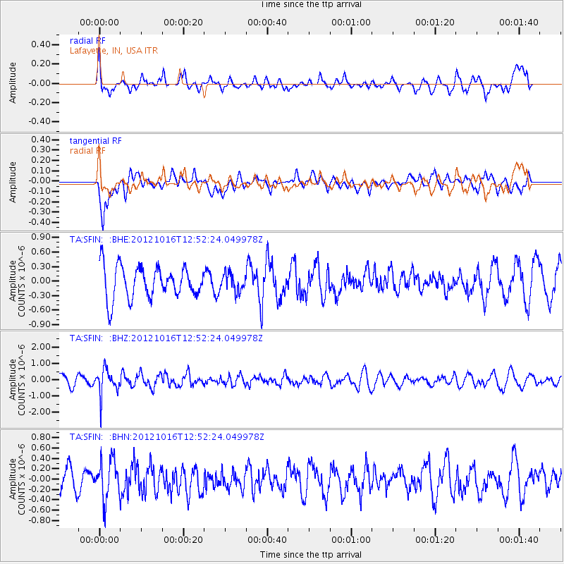
SFIN Lafayette, IN, USA - Earthquake Result Viewer
*The percent match for this event was below the threshold and hence no stack was calculated.
| Earthquake location: |
Kuril Islands |
| Earthquake latitude/longitude: |
49.6/156.4 |
| Earthquake time(UTC): |
2012/10/16 (290) 12:41:25 GMT |
| Earthquake Depth: |
81 km |
| Earthquake Magnitude: |
6.2 MB, 5.6 MW, 5.6 MW |
| Earthquake Catalog/Contributor: |
WHDF/NEIC |
|
| Network: |
TA USArray Transportable Network (new EarthScope stations) |
| Station: |
SFIN Lafayette, IN, USA |
| Lat/Lon: |
40.38 N/87.10 W |
| Elevation: |
165 m |
|
| Distance: |
74.4 deg |
| Az: |
45.233 deg |
| Baz: |
322.808 deg |
| Ray Param: |
$rayparam |
*The percent match for this event was below the threshold and hence was not used in the summary stack. |
|
| Radial Match: |
48.194515 % |
| Radial Bump: |
400 |
| Transverse Match: |
71.894264 % |
| Transverse Bump: |
400 |
| SOD ConfigId: |
478790 |
| Insert Time: |
2013-02-23 05:12:52.707 +0000 |
| GWidth: |
2.5 |
| Max Bumps: |
400 |
| Tol: |
0.001 |
|
Signal To Noise
| Channel | StoN | STA | LTA |
| TA:SFIN: :BHZ:20121016T12:52:24.049978Z | 2.1330233 | 7.790222E-7 | 3.6521976E-7 |
| TA:SFIN: :BHN:20121016T12:52:24.049978Z | 0.9140487 | 3.835726E-7 | 4.1964134E-7 |
| TA:SFIN: :BHE:20121016T12:52:24.049978Z | 0.5816104 | 1.9151614E-7 | 3.2928597E-7 |
| Arrivals |
| Ps | |
| PpPs | |
| PsPs/PpSs | |


