You are here: Home > Network List > TA - USArray Transportable Network (new EarthScope stations) Stations List
> Station S45A Carrier Mills, IL, USA > Earthquake Result Viewer
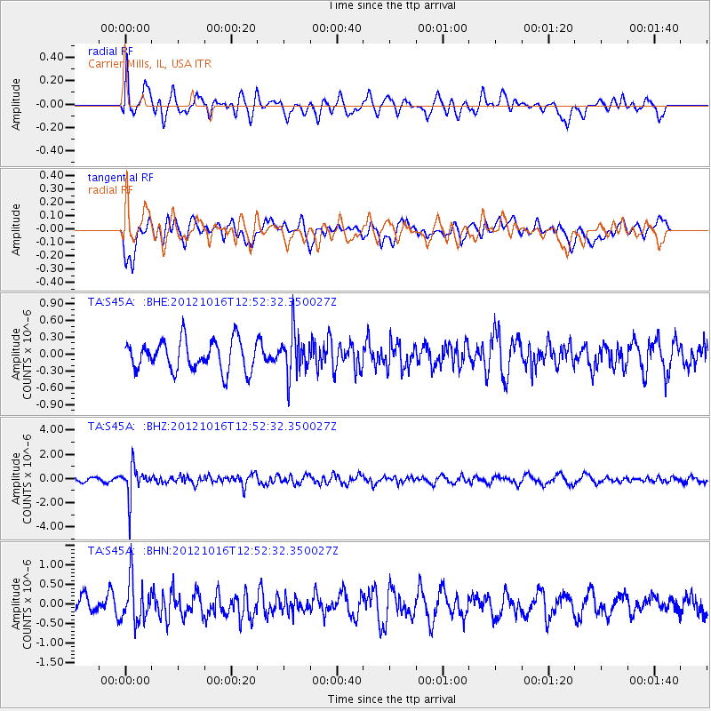
S45A Carrier Mills, IL, USA - Earthquake Result Viewer
*The percent match for this event was below the threshold and hence no stack was calculated.
| Earthquake location: |
Kuril Islands |
| Earthquake latitude/longitude: |
49.6/156.4 |
| Earthquake time(UTC): |
2012/10/16 (290) 12:41:25 GMT |
| Earthquake Depth: |
81 km |
| Earthquake Magnitude: |
6.2 MB, 5.6 MW, 5.6 MW |
| Earthquake Catalog/Contributor: |
WHDF/NEIC |
|
| Network: |
TA USArray Transportable Network (new EarthScope stations) |
| Station: |
S45A Carrier Mills, IL, USA |
| Lat/Lon: |
37.68 N/88.58 W |
| Elevation: |
122 m |
|
| Distance: |
75.9 deg |
| Az: |
47.876 deg |
| Baz: |
322.556 deg |
| Ray Param: |
$rayparam |
*The percent match for this event was below the threshold and hence was not used in the summary stack. |
|
| Radial Match: |
73.6011 % |
| Radial Bump: |
400 |
| Transverse Match: |
58.03291 % |
| Transverse Bump: |
400 |
| SOD ConfigId: |
478790 |
| Insert Time: |
2013-02-23 05:30:40.426 +0000 |
| GWidth: |
2.5 |
| Max Bumps: |
400 |
| Tol: |
0.001 |
|
Signal To Noise
| Channel | StoN | STA | LTA |
| TA:S45A: :BHZ:20121016T12:52:32.350027Z | 6.2153544 | 1.2799262E-6 | 2.0592972E-7 |
| TA:S45A: :BHN:20121016T12:52:32.350027Z | 3.2760422 | 5.425807E-7 | 1.656208E-7 |
| TA:S45A: :BHE:20121016T12:52:32.350027Z | 1.4466156 | 3.8477364E-7 | 2.6598195E-7 |
| Arrivals |
| Ps | |
| PpPs | |
| PsPs/PpSs | |


