You are here: Home > Network List > II - Global Seismograph Network (GSN - IRIS/IDA) Stations List
> Station WRAB Tennant Creek, NT, Australia > Earthquake Result Viewer
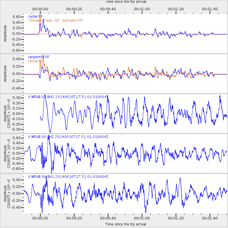
WRAB Tennant Creek, NT, Australia - Earthquake Result Viewer
*The percent match for this event was below the threshold and hence no stack was calculated.
| Earthquake location: |
Southeast Of Honshu, Japan |
| Earthquake latitude/longitude: |
33.9/139.7 |
| Earthquake time(UTC): |
2014/06/16 (167) 17:42:22 GMT |
| Earthquake Depth: |
132 km |
| Earthquake Magnitude: |
5.3 MW |
| Earthquake Catalog/Contributor: |
ISC/ISC |
|
| Network: |
II Global Seismograph Network (GSN - IRIS/IDA) |
| Station: |
WRAB Tennant Creek, NT, Australia |
| Lat/Lon: |
19.93 S/134.36 E |
| Elevation: |
366 m |
|
| Distance: |
53.8 deg |
| Az: |
186.179 deg |
| Baz: |
5.457 deg |
| Ray Param: |
$rayparam |
*The percent match for this event was below the threshold and hence was not used in the summary stack. |
|
| Radial Match: |
68.25132 % |
| Radial Bump: |
400 |
| Transverse Match: |
60.364815 % |
| Transverse Bump: |
400 |
| SOD ConfigId: |
3390531 |
| Insert Time: |
2019-04-12 08:03:00.847 +0000 |
| GWidth: |
2.5 |
| Max Bumps: |
400 |
| Tol: |
0.001 |
|
Signal To Noise
| Channel | StoN | STA | LTA |
| II:WRAB:00:BHZ:20140616T17:51:01.019004Z | 1.9494566 | 3.3592738E-7 | 1.7231848E-7 |
| II:WRAB:00:BH1:20140616T17:51:01.019004Z | 1.9797388 | 2.3005646E-7 | 1.16205456E-7 |
| II:WRAB:00:BH2:20140616T17:51:01.019004Z | 1.0070319 | 1.5244551E-7 | 1.5138102E-7 |
| Arrivals |
| Ps | |
| PpPs | |
| PsPs/PpSs | |


