You are here: Home > Network List > TA - USArray Transportable Network (new EarthScope stations) Stations List
> Station L39A Vinton, IA, USA > Earthquake Result Viewer
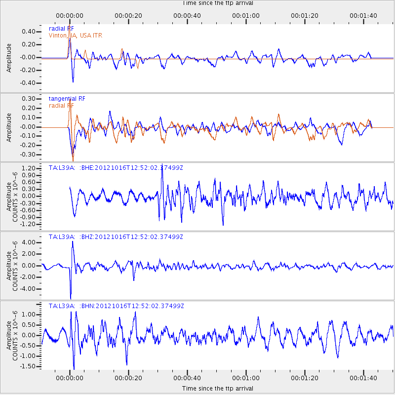
L39A Vinton, IA, USA - Earthquake Result Viewer
*The percent match for this event was below the threshold and hence no stack was calculated.
| Earthquake location: |
Kuril Islands |
| Earthquake latitude/longitude: |
49.6/156.4 |
| Earthquake time(UTC): |
2012/10/16 (290) 12:41:25 GMT |
| Earthquake Depth: |
81 km |
| Earthquake Magnitude: |
6.2 MB, 5.6 MW, 5.6 MW |
| Earthquake Catalog/Contributor: |
WHDF/NEIC |
|
| Network: |
TA USArray Transportable Network (new EarthScope stations) |
| Station: |
L39A Vinton, IA, USA |
| Lat/Lon: |
42.12 N/92.00 W |
| Elevation: |
261 m |
|
| Distance: |
70.7 deg |
| Az: |
47.128 deg |
| Baz: |
320.153 deg |
| Ray Param: |
$rayparam |
*The percent match for this event was below the threshold and hence was not used in the summary stack. |
|
| Radial Match: |
71.4282 % |
| Radial Bump: |
400 |
| Transverse Match: |
71.476 % |
| Transverse Bump: |
400 |
| SOD ConfigId: |
478790 |
| Insert Time: |
2013-02-23 05:32:48.895 +0000 |
| GWidth: |
2.5 |
| Max Bumps: |
400 |
| Tol: |
0.001 |
|
Signal To Noise
| Channel | StoN | STA | LTA |
| TA:L39A: :BHZ:20121016T12:52:02.37499Z | 5.244839 | 1.8433776E-6 | 3.5146505E-7 |
| TA:L39A: :BHN:20121016T12:52:02.37499Z | 3.1866937 | 6.836903E-7 | 2.1454535E-7 |
| TA:L39A: :BHE:20121016T12:52:02.37499Z | 2.2349367 | 5.203974E-7 | 2.328466E-7 |
| Arrivals |
| Ps | |
| PpPs | |
| PsPs/PpSs | |


