You are here: Home > Network List > TA - USArray Transportable Network (new EarthScope stations) Stations List
> Station M42A Sheffield, IL, USA > Earthquake Result Viewer
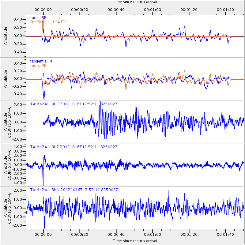
M42A Sheffield, IL, USA - Earthquake Result Viewer
*The percent match for this event was below the threshold and hence no stack was calculated.
| Earthquake location: |
Kuril Islands |
| Earthquake latitude/longitude: |
49.6/156.4 |
| Earthquake time(UTC): |
2012/10/16 (290) 12:41:25 GMT |
| Earthquake Depth: |
81 km |
| Earthquake Magnitude: |
6.2 MB, 5.6 MW, 5.6 MW |
| Earthquake Catalog/Contributor: |
WHDF/NEIC |
|
| Network: |
TA USArray Transportable Network (new EarthScope stations) |
| Station: |
M42A Sheffield, IL, USA |
| Lat/Lon: |
41.45 N/89.76 W |
| Elevation: |
212 m |
|
| Distance: |
72.3 deg |
| Az: |
46.205 deg |
| Baz: |
321.35 deg |
| Ray Param: |
$rayparam |
*The percent match for this event was below the threshold and hence was not used in the summary stack. |
|
| Radial Match: |
50.78765 % |
| Radial Bump: |
400 |
| Transverse Match: |
66.43669 % |
| Transverse Bump: |
400 |
| SOD ConfigId: |
478790 |
| Insert Time: |
2013-02-23 05:34:58.855 +0000 |
| GWidth: |
2.5 |
| Max Bumps: |
400 |
| Tol: |
0.001 |
|
Signal To Noise
| Channel | StoN | STA | LTA |
| TA:M42A: :BHZ:20121016T12:52:11.825002Z | 3.7034953 | 1.1467512E-6 | 3.0964023E-7 |
| TA:M42A: :BHN:20121016T12:52:11.825002Z | 1.8735641 | 8.086867E-7 | 4.3163013E-7 |
| TA:M42A: :BHE:20121016T12:52:11.825002Z | 4.2383456 | 1.0757457E-6 | 2.5381263E-7 |
| Arrivals |
| Ps | |
| PpPs | |
| PsPs/PpSs | |


