You are here: Home > Network List > TA - USArray Transportable Network (new EarthScope stations) Stations List
> Station S48A Wiedeman Farm, Cecilia, KY, USA > Earthquake Result Viewer
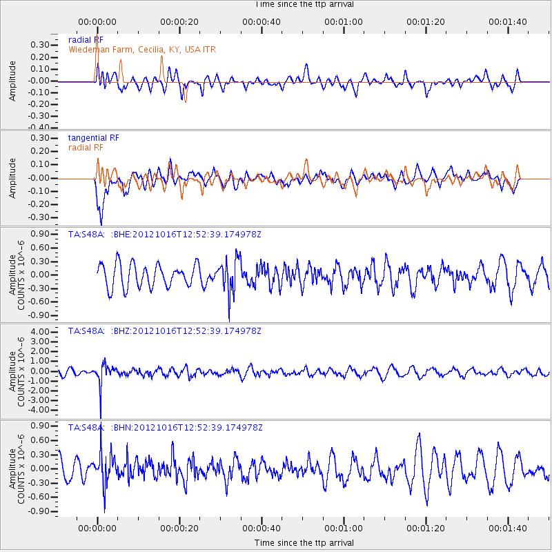
S48A Wiedeman Farm, Cecilia, KY, USA - Earthquake Result Viewer
*The percent match for this event was below the threshold and hence no stack was calculated.
| Earthquake location: |
Kuril Islands |
| Earthquake latitude/longitude: |
49.6/156.4 |
| Earthquake time(UTC): |
2012/10/16 (290) 12:41:25 GMT |
| Earthquake Depth: |
81 km |
| Earthquake Magnitude: |
6.2 MB, 5.6 MW, 5.6 MW |
| Earthquake Catalog/Contributor: |
WHDF/NEIC |
|
| Network: |
TA USArray Transportable Network (new EarthScope stations) |
| Station: |
S48A Wiedeman Farm, Cecilia, KY, USA |
| Lat/Lon: |
37.66 N/86.06 W |
| Elevation: |
238 m |
|
| Distance: |
77.1 deg |
| Az: |
46.241 deg |
| Baz: |
323.709 deg |
| Ray Param: |
$rayparam |
*The percent match for this event was below the threshold and hence was not used in the summary stack. |
|
| Radial Match: |
54.07112 % |
| Radial Bump: |
400 |
| Transverse Match: |
62.21884 % |
| Transverse Bump: |
400 |
| SOD ConfigId: |
478790 |
| Insert Time: |
2013-02-23 05:47:10.435 +0000 |
| GWidth: |
2.5 |
| Max Bumps: |
400 |
| Tol: |
0.001 |
|
Signal To Noise
| Channel | StoN | STA | LTA |
| TA:S48A: :BHZ:20121016T12:52:39.174978Z | 3.3797925 | 1.0478587E-6 | 3.1003643E-7 |
| TA:S48A: :BHN:20121016T12:52:39.174978Z | 1.6957123 | 3.3359152E-7 | 1.9672649E-7 |
| TA:S48A: :BHE:20121016T12:52:39.174978Z | 1.4427468 | 3.6589267E-7 | 2.5360836E-7 |
| Arrivals |
| Ps | |
| PpPs | |
| PsPs/PpSs | |


