You are here: Home > Network List > TA - USArray Transportable Network (new EarthScope stations) Stations List
> Station 254A Abbeville, GA, USA > Earthquake Result Viewer
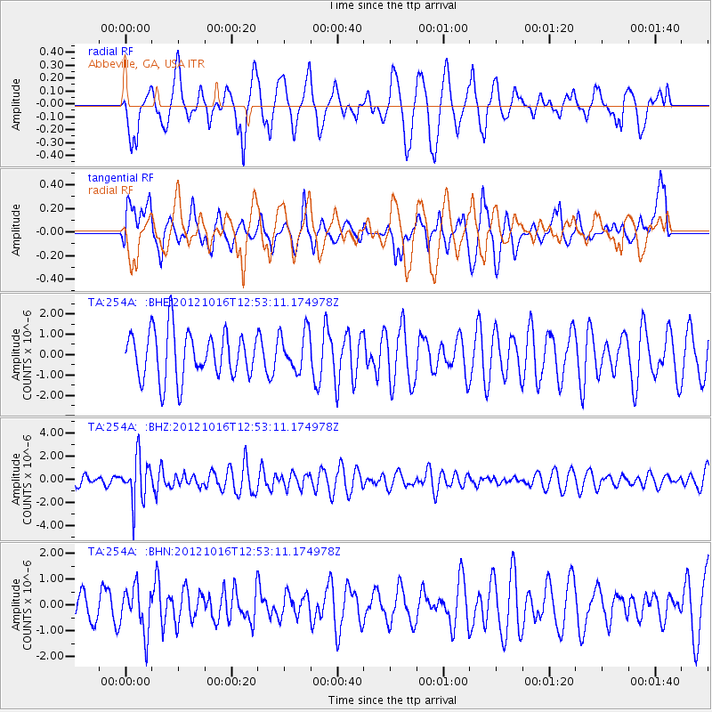
254A Abbeville, GA, USA - Earthquake Result Viewer
*The percent match for this event was below the threshold and hence no stack was calculated.
| Earthquake location: |
Kuril Islands |
| Earthquake latitude/longitude: |
49.6/156.4 |
| Earthquake time(UTC): |
2012/10/16 (290) 12:41:25 GMT |
| Earthquake Depth: |
81 km |
| Earthquake Magnitude: |
6.2 MB, 5.6 MW, 5.6 MW |
| Earthquake Catalog/Contributor: |
WHDF/NEIC |
|
| Network: |
TA USArray Transportable Network (new EarthScope stations) |
| Station: |
254A Abbeville, GA, USA |
| Lat/Lon: |
31.95 N/83.29 W |
| Elevation: |
78 m |
|
| Distance: |
83.0 deg |
| Az: |
47.704 deg |
| Baz: |
325.536 deg |
| Ray Param: |
$rayparam |
*The percent match for this event was below the threshold and hence was not used in the summary stack. |
|
| Radial Match: |
61.390636 % |
| Radial Bump: |
400 |
| Transverse Match: |
60.048367 % |
| Transverse Bump: |
400 |
| SOD ConfigId: |
478790 |
| Insert Time: |
2013-02-23 10:03:06.095 +0000 |
| GWidth: |
2.5 |
| Max Bumps: |
400 |
| Tol: |
0.001 |
|
Signal To Noise
| Channel | StoN | STA | LTA |
| TA:254A: :BHZ:20121016T12:53:11.174978Z | 3.6752272 | 1.9427594E-6 | 5.2860935E-7 |
| TA:254A: :BHN:20121016T12:53:11.174978Z | 1.1251149 | 8.770164E-7 | 7.7949056E-7 |
| TA:254A: :BHE:20121016T12:53:11.174978Z | 0.83177847 | 9.709995E-7 | 1.1673775E-6 |
| Arrivals |
| Ps | |
| PpPs | |
| PsPs/PpSs | |


