You are here: Home > Network List > TA - USArray Transportable Network (new EarthScope stations) Stations List
> Station Z51A Franklin, GA, USA > Earthquake Result Viewer
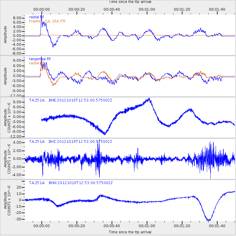
Z51A Franklin, GA, USA - Earthquake Result Viewer
*The percent match for this event was below the threshold and hence no stack was calculated.
| Earthquake location: |
Kuril Islands |
| Earthquake latitude/longitude: |
49.6/156.4 |
| Earthquake time(UTC): |
2012/10/16 (290) 12:41:25 GMT |
| Earthquake Depth: |
81 km |
| Earthquake Magnitude: |
6.2 MB, 5.6 MW, 5.6 MW |
| Earthquake Catalog/Contributor: |
WHDF/NEIC |
|
| Network: |
TA USArray Transportable Network (new EarthScope stations) |
| Station: |
Z51A Franklin, GA, USA |
| Lat/Lon: |
33.32 N/85.17 W |
| Elevation: |
249 m |
|
| Distance: |
81.0 deg |
| Az: |
48.23 deg |
| Baz: |
324.597 deg |
| Ray Param: |
$rayparam |
*The percent match for this event was below the threshold and hence was not used in the summary stack. |
|
| Radial Match: |
29.740469 % |
| Radial Bump: |
355 |
| Transverse Match: |
31.63559 % |
| Transverse Bump: |
376 |
| SOD ConfigId: |
478790 |
| Insert Time: |
2013-02-23 10:04:50.143 +0000 |
| GWidth: |
2.5 |
| Max Bumps: |
400 |
| Tol: |
0.001 |
|
Signal To Noise
| Channel | StoN | STA | LTA |
| TA:Z51A: :BHZ:20121016T12:53:00.575002Z | 2.0063818 | 1.070508E-6 | 5.3355154E-7 |
| TA:Z51A: :BHN:20121016T12:53:00.575002Z | 1.7149247 | 1.6541582E-6 | 9.645661E-7 |
| TA:Z51A: :BHE:20121016T12:53:00.575002Z | 7.4182553 | 6.7988876E-6 | 9.1650764E-7 |
| Arrivals |
| Ps | |
| PpPs | |
| PsPs/PpSs | |


