You are here: Home > Network List > TA - USArray Transportable Network (new EarthScope stations) Stations List
> Station MDND Maddock, ND, USA > Earthquake Result Viewer
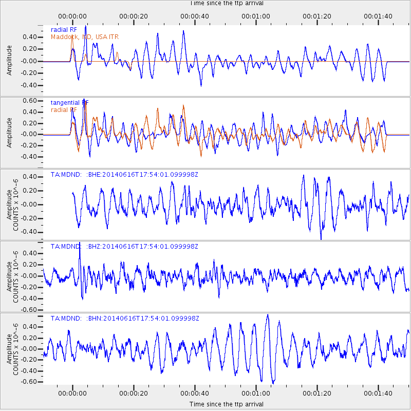
MDND Maddock, ND, USA - Earthquake Result Viewer
*The percent match for this event was below the threshold and hence no stack was calculated.
| Earthquake location: |
Southeast Of Honshu, Japan |
| Earthquake latitude/longitude: |
33.9/139.7 |
| Earthquake time(UTC): |
2014/06/16 (167) 17:42:22 GMT |
| Earthquake Depth: |
132 km |
| Earthquake Magnitude: |
5.3 MW |
| Earthquake Catalog/Contributor: |
ISC/ISC |
|
| Network: |
TA USArray Transportable Network (new EarthScope stations) |
| Station: |
MDND Maddock, ND, USA |
| Lat/Lon: |
47.85 N/99.60 W |
| Elevation: |
479 m |
|
| Distance: |
82.8 deg |
| Az: |
35.696 deg |
| Baz: |
313.933 deg |
| Ray Param: |
$rayparam |
*The percent match for this event was below the threshold and hence was not used in the summary stack. |
|
| Radial Match: |
49.987118 % |
| Radial Bump: |
400 |
| Transverse Match: |
50.22529 % |
| Transverse Bump: |
400 |
| SOD ConfigId: |
3390531 |
| Insert Time: |
2019-04-12 08:06:13.235 +0000 |
| GWidth: |
2.5 |
| Max Bumps: |
400 |
| Tol: |
0.001 |
|
Signal To Noise
| Channel | StoN | STA | LTA |
| TA:MDND: :BHZ:20140616T17:54:01.099998Z | 2.2686076 | 2.0311792E-7 | 8.953418E-8 |
| TA:MDND: :BHN:20140616T17:54:01.099998Z | 0.7299549 | 1.1965942E-7 | 1.6392713E-7 |
| TA:MDND: :BHE:20140616T17:54:01.099998Z | 1.3759248 | 1.9508684E-7 | 1.4178597E-7 |
| Arrivals |
| Ps | |
| PpPs | |
| PsPs/PpSs | |


