You are here: Home > Network List > TA - USArray Transportable Network (new EarthScope stations) Stations List
> Station Q51A Peebles, OH, USA > Earthquake Result Viewer
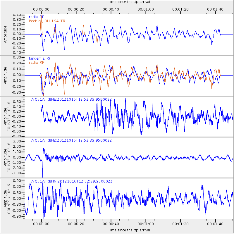
Q51A Peebles, OH, USA - Earthquake Result Viewer
*The percent match for this event was below the threshold and hence no stack was calculated.
| Earthquake location: |
Kuril Islands |
| Earthquake latitude/longitude: |
49.6/156.4 |
| Earthquake time(UTC): |
2012/10/16 (290) 12:41:25 GMT |
| Earthquake Depth: |
81 km |
| Earthquake Magnitude: |
6.2 MB, 5.6 MW, 5.6 MW |
| Earthquake Catalog/Contributor: |
WHDF/NEIC |
|
| Network: |
TA USArray Transportable Network (new EarthScope stations) |
| Station: |
Q51A Peebles, OH, USA |
| Lat/Lon: |
39.03 N/83.35 W |
| Elevation: |
362 m |
|
| Distance: |
77.2 deg |
| Az: |
43.647 deg |
| Baz: |
324.807 deg |
| Ray Param: |
$rayparam |
*The percent match for this event was below the threshold and hence was not used in the summary stack. |
|
| Radial Match: |
56.127293 % |
| Radial Bump: |
400 |
| Transverse Match: |
66.70372 % |
| Transverse Bump: |
400 |
| SOD ConfigId: |
478790 |
| Insert Time: |
2013-02-23 10:13:19.154 +0000 |
| GWidth: |
2.5 |
| Max Bumps: |
400 |
| Tol: |
0.001 |
|
Signal To Noise
| Channel | StoN | STA | LTA |
| TA:Q51A: :BHZ:20121016T12:52:39.950002Z | 3.6464643 | 1.0132156E-6 | 2.7786248E-7 |
| TA:Q51A: :BHN:20121016T12:52:39.950002Z | 1.1701648 | 4.422913E-7 | 3.779735E-7 |
| TA:Q51A: :BHE:20121016T12:52:39.950002Z | 2.190453 | 3.183971E-7 | 1.4535674E-7 |
| Arrivals |
| Ps | |
| PpPs | |
| PsPs/PpSs | |


