You are here: Home > Network List > US - United States National Seismic Network Stations List
> Station MNTX Cornudas Mountains, Texas, USA > Earthquake Result Viewer
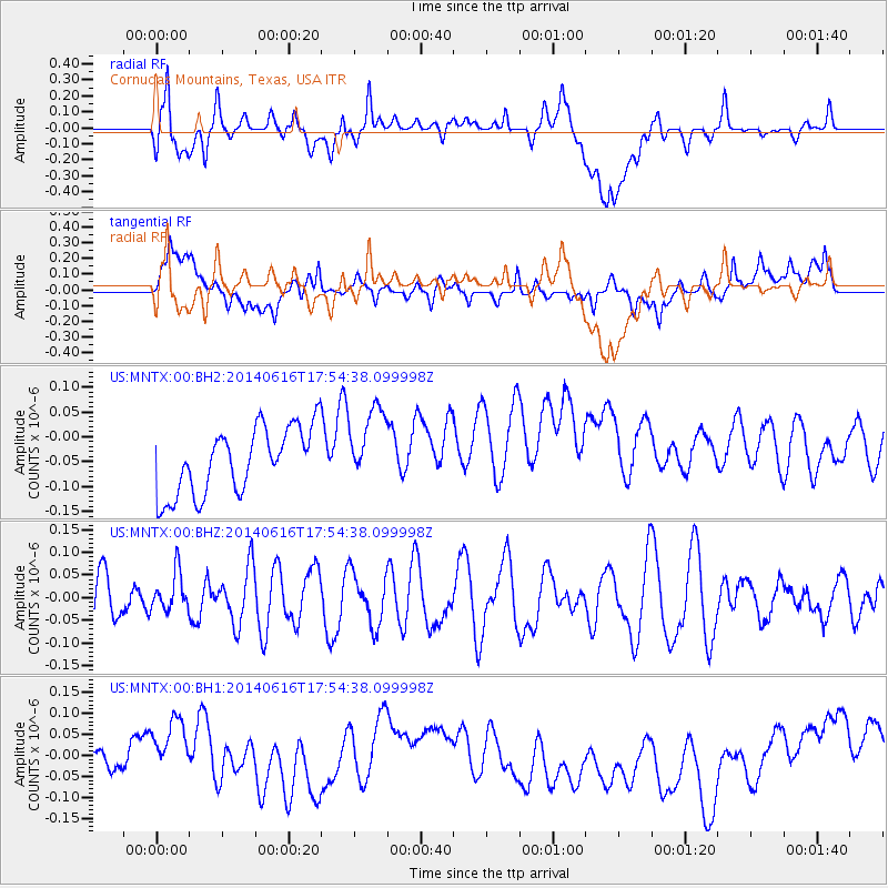
MNTX Cornudas Mountains, Texas, USA - Earthquake Result Viewer
*The percent match for this event was below the threshold and hence no stack was calculated.
| Earthquake location: |
Southeast Of Honshu, Japan |
| Earthquake latitude/longitude: |
33.9/139.7 |
| Earthquake time(UTC): |
2014/06/16 (167) 17:42:22 GMT |
| Earthquake Depth: |
132 km |
| Earthquake Magnitude: |
5.3 MW |
| Earthquake Catalog/Contributor: |
ISC/ISC |
|
| Network: |
US United States National Seismic Network |
| Station: |
MNTX Cornudas Mountains, Texas, USA |
| Lat/Lon: |
31.70 N/105.38 W |
| Elevation: |
404 m |
|
| Distance: |
90.5 deg |
| Az: |
50.607 deg |
| Baz: |
311.086 deg |
| Ray Param: |
$rayparam |
*The percent match for this event was below the threshold and hence was not used in the summary stack. |
|
| Radial Match: |
36.50324 % |
| Radial Bump: |
400 |
| Transverse Match: |
32.667984 % |
| Transverse Bump: |
400 |
| SOD ConfigId: |
3390531 |
| Insert Time: |
2019-04-12 08:06:55.138 +0000 |
| GWidth: |
2.5 |
| Max Bumps: |
400 |
| Tol: |
0.001 |
|
Signal To Noise
| Channel | StoN | STA | LTA |
| US:MNTX:00:BHZ:20140616T17:54:38.099998Z | 0.59041256 | 4.239338E-8 | 7.180298E-8 |
| US:MNTX:00:BH1:20140616T17:54:38.099998Z | 1.3946766 | 6.611658E-8 | 4.740639E-8 |
| US:MNTX:00:BH2:20140616T17:54:38.099998Z | 1.1830826 | 7.865546E-8 | 6.6483494E-8 |
| Arrivals |
| Ps | |
| PpPs | |
| PsPs/PpSs | |


