You are here: Home > Network List > CN - Canadian National Seismograph Network Stations List
> Station INK INUVIK, NT > Earthquake Result Viewer
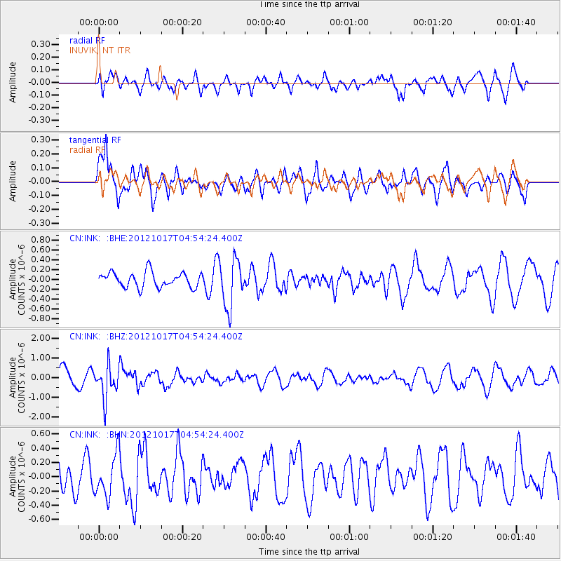
INK INUVIK, NT - Earthquake Result Viewer
*The percent match for this event was below the threshold and hence no stack was calculated.
| Earthquake location: |
Celebes Sea |
| Earthquake latitude/longitude: |
4.2/124.5 |
| Earthquake time(UTC): |
2012/10/17 (291) 04:42:30 GMT |
| Earthquake Depth: |
326 km |
| Earthquake Magnitude: |
5.9 MB, 6.0 MW, 6.1 MW |
| Earthquake Catalog/Contributor: |
WHDF/NEIC |
|
| Network: |
CN Canadian National Seismograph Network |
| Station: |
INK INUVIK, NT |
| Lat/Lon: |
68.31 N/133.53 W |
| Elevation: |
44 m |
|
| Distance: |
90.5 deg |
| Az: |
21.33 deg |
| Baz: |
282.652 deg |
| Ray Param: |
$rayparam |
*The percent match for this event was below the threshold and hence was not used in the summary stack. |
|
| Radial Match: |
51.466057 % |
| Radial Bump: |
400 |
| Transverse Match: |
71.227455 % |
| Transverse Bump: |
400 |
| SOD ConfigId: |
478790 |
| Insert Time: |
2013-02-23 10:44:05.992 +0000 |
| GWidth: |
2.5 |
| Max Bumps: |
400 |
| Tol: |
0.001 |
|
Signal To Noise
| Channel | StoN | STA | LTA |
| CN:INK: :BHZ:20121017T04:54:24.400Z | 2.1873605 | 8.484365E-7 | 3.8788144E-7 |
| CN:INK: :BHN:20121017T04:54:24.400Z | 1.1762573 | 2.9756262E-7 | 2.529741E-7 |
| CN:INK: :BHE:20121017T04:54:24.400Z | 3.2075012 | 4.8841207E-7 | 1.5227182E-7 |
| Arrivals |
| Ps | |
| PpPs | |
| PsPs/PpSs | |


