You are here: Home > Network List > G - GEOSCOPE Stations List
> Station INU Inuyama, Japan > Earthquake Result Viewer
INU Inuyama, Japan - Earthquake Result Viewer
*The percent match for this event was below the threshold and hence no stack was calculated.
| Earthquake location: |
Celebes Sea |
| Earthquake latitude/longitude: |
4.2/124.5 |
| Earthquake time(UTC): |
2012/10/17 (291) 04:42:30 GMT |
| Earthquake Depth: |
326 km |
| Earthquake Magnitude: |
5.9 MB, 6.0 MW, 6.1 MW |
| Earthquake Catalog/Contributor: |
WHDF/NEIC |
|
| Network: |
G GEOSCOPE |
| Station: |
INU Inuyama, Japan |
| Lat/Lon: |
35.35 N/137.03 E |
| Elevation: |
132 m |
|
| Distance: |
33.1 deg |
| Az: |
18.941 deg |
| Baz: |
203.329 deg |
| Ray Param: |
$rayparam |
*The percent match for this event was below the threshold and hence was not used in the summary stack. |
|
| Radial Match: |
75.921394 % |
| Radial Bump: |
365 |
| Transverse Match: |
58.666557 % |
| Transverse Bump: |
384 |
| SOD ConfigId: |
478790 |
| Insert Time: |
2013-02-23 10:44:26.533 +0000 |
| GWidth: |
2.5 |
| Max Bumps: |
400 |
| Tol: |
0.001 |
|
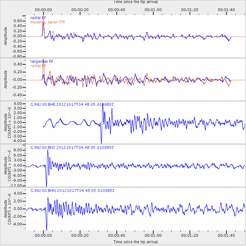
Signal To Noise
| Channel | StoN | STA | LTA |
| G:INU:00:BHZ:20121017T04:48:05.910986Z | 11.285482 | 4.2596967E-6 | 3.7744925E-7 |
| G:INU:00:BHN:20121017T04:48:05.910986Z | 5.98342 | 1.7249944E-6 | 2.8829572E-7 |
| G:INU:00:BHE:20121017T04:48:05.910986Z | 3.8121884 | 1.7037265E-6 | 4.4691564E-7 |
| Arrivals |
| Ps | |
| PpPs | |
| PsPs/PpSs | |


