You are here: Home > Network List > TA - USArray Transportable Network (new EarthScope stations) Stations List
> Station HDA Harding Lake, AK, USA > Earthquake Result Viewer
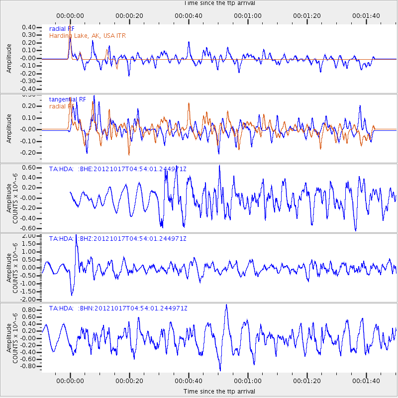
HDA Harding Lake, AK, USA - Earthquake Result Viewer
*The percent match for this event was below the threshold and hence no stack was calculated.
| Earthquake location: |
Celebes Sea |
| Earthquake latitude/longitude: |
4.2/124.5 |
| Earthquake time(UTC): |
2012/10/17 (291) 04:42:30 GMT |
| Earthquake Depth: |
326 km |
| Earthquake Magnitude: |
5.9 MB, 6.0 MW, 6.1 MW |
| Earthquake Catalog/Contributor: |
WHDF/NEIC |
|
| Network: |
TA USArray Transportable Network (new EarthScope stations) |
| Station: |
HDA Harding Lake, AK, USA |
| Lat/Lon: |
64.41 N/146.95 W |
| Elevation: |
437 m |
|
| Distance: |
85.6 deg |
| Az: |
25.815 deg |
| Baz: |
270.507 deg |
| Ray Param: |
$rayparam |
*The percent match for this event was below the threshold and hence was not used in the summary stack. |
|
| Radial Match: |
73.84456 % |
| Radial Bump: |
400 |
| Transverse Match: |
68.92434 % |
| Transverse Bump: |
400 |
| SOD ConfigId: |
478790 |
| Insert Time: |
2013-02-23 15:27:35.090 +0000 |
| GWidth: |
2.5 |
| Max Bumps: |
400 |
| Tol: |
0.001 |
|
Signal To Noise
| Channel | StoN | STA | LTA |
| TA:HDA: :BHZ:20121017T04:54:01.244971Z | 3.9382405 | 9.236618E-7 | 2.3453667E-7 |
| TA:HDA: :BHN:20121017T04:54:01.244971Z | 0.96894234 | 2.3847826E-7 | 2.4612223E-7 |
| TA:HDA: :BHE:20121017T04:54:01.244971Z | 2.0070198 | 3.1360926E-7 | 1.5625618E-7 |
| Arrivals |
| Ps | |
| PpPs | |
| PsPs/PpSs | |


