You are here: Home > Network List > TA - USArray Transportable Network (new EarthScope stations) Stations List
> Station R11A Troy Canyon, Currant, NV, USA > Earthquake Result Viewer
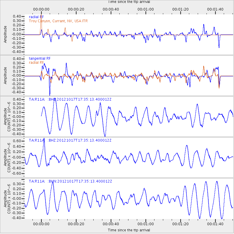
R11A Troy Canyon, Currant, NV, USA - Earthquake Result Viewer
*The percent match for this event was below the threshold and hence no stack was calculated.
| Earthquake location: |
Tonga Islands |
| Earthquake latitude/longitude: |
-19.0/-174.2 |
| Earthquake time(UTC): |
2012/10/17 (291) 17:23:42 GMT |
| Earthquake Depth: |
35 km |
| Earthquake Magnitude: |
5.5 MB, 5.0 MS, 5.4 MW |
| Earthquake Catalog/Contributor: |
WHDF/NEIC |
|
| Network: |
TA USArray Transportable Network (new EarthScope stations) |
| Station: |
R11A Troy Canyon, Currant, NV, USA |
| Lat/Lon: |
38.35 N/115.59 W |
| Elevation: |
1756 m |
|
| Distance: |
79.2 deg |
| Az: |
43.094 deg |
| Baz: |
235.28 deg |
| Ray Param: |
$rayparam |
*The percent match for this event was below the threshold and hence was not used in the summary stack. |
|
| Radial Match: |
55.718243 % |
| Radial Bump: |
387 |
| Transverse Match: |
61.87105 % |
| Transverse Bump: |
400 |
| SOD ConfigId: |
478790 |
| Insert Time: |
2013-02-23 15:35:27.900 +0000 |
| GWidth: |
2.5 |
| Max Bumps: |
400 |
| Tol: |
0.001 |
|
Signal To Noise
| Channel | StoN | STA | LTA |
| TA:R11A: :BHZ:20121017T17:35:13.400012Z | 1.9448762 | 3.109087E-7 | 1.598604E-7 |
| TA:R11A: :BHN:20121017T17:35:13.400012Z | 1.2644343 | 1.8301017E-7 | 1.4473679E-7 |
| TA:R11A: :BHE:20121017T17:35:13.400012Z | 0.76336163 | 1.744551E-7 | 2.2853533E-7 |
| Arrivals |
| Ps | |
| PpPs | |
| PsPs/PpSs | |


