You are here: Home > Network List > TA - USArray Transportable Network (new EarthScope stations) Stations List
> Station K37A Belmond, IA, USA > Earthquake Result Viewer
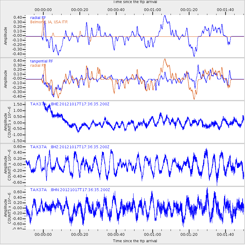
K37A Belmond, IA, USA - Earthquake Result Viewer
*The percent match for this event was below the threshold and hence no stack was calculated.
| Earthquake location: |
Tonga Islands |
| Earthquake latitude/longitude: |
-19.0/-174.2 |
| Earthquake time(UTC): |
2012/10/17 (291) 17:23:42 GMT |
| Earthquake Depth: |
35 km |
| Earthquake Magnitude: |
5.5 MB, 5.0 MS, 5.4 MW |
| Earthquake Catalog/Contributor: |
WHDF/NEIC |
|
| Network: |
TA USArray Transportable Network (new EarthScope stations) |
| Station: |
K37A Belmond, IA, USA |
| Lat/Lon: |
42.77 N/93.64 W |
| Elevation: |
365 m |
|
| Distance: |
96.0 deg |
| Az: |
46.923 deg |
| Baz: |
249.768 deg |
| Ray Param: |
$rayparam |
*The percent match for this event was below the threshold and hence was not used in the summary stack. |
|
| Radial Match: |
18.521385 % |
| Radial Bump: |
400 |
| Transverse Match: |
40.069344 % |
| Transverse Bump: |
400 |
| SOD ConfigId: |
478790 |
| Insert Time: |
2013-02-23 15:36:36.457 +0000 |
| GWidth: |
2.5 |
| Max Bumps: |
400 |
| Tol: |
0.001 |
|
Signal To Noise
| Channel | StoN | STA | LTA |
| TA:K37A: :BHZ:20121017T17:36:35.200Z | 1.3320194 | 2.2648551E-7 | 1.7003168E-7 |
| TA:K37A: :BHN:20121017T17:36:35.200Z | 0.5655461 | 1.1516677E-7 | 2.0363817E-7 |
| TA:K37A: :BHE:20121017T17:36:35.200Z | 0.6359727 | 3.9469845E-7 | 6.2062173E-7 |
| Arrivals |
| Ps | |
| PpPs | |
| PsPs/PpSs | |


