You are here: Home > Network List > TA - USArray Transportable Network (new EarthScope stations) Stations List
> Station R41A Rosebud, MO, USA > Earthquake Result Viewer
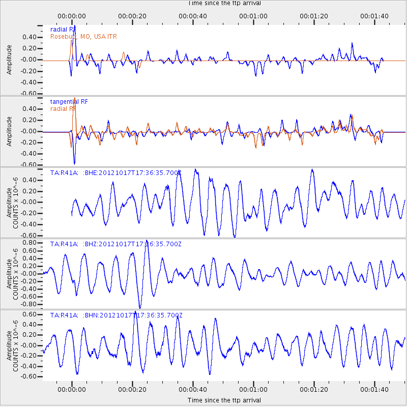
R41A Rosebud, MO, USA - Earthquake Result Viewer
*The percent match for this event was below the threshold and hence no stack was calculated.
| Earthquake location: |
Tonga Islands |
| Earthquake latitude/longitude: |
-19.0/-174.2 |
| Earthquake time(UTC): |
2012/10/17 (291) 17:23:42 GMT |
| Earthquake Depth: |
35 km |
| Earthquake Magnitude: |
5.5 MB, 5.0 MS, 5.4 MW |
| Earthquake Catalog/Contributor: |
WHDF/NEIC |
|
| Network: |
TA USArray Transportable Network (new EarthScope stations) |
| Station: |
R41A Rosebud, MO, USA |
| Lat/Lon: |
38.30 N/91.38 W |
| Elevation: |
257 m |
|
| Distance: |
96.1 deg |
| Az: |
51.733 deg |
| Baz: |
250.721 deg |
| Ray Param: |
$rayparam |
*The percent match for this event was below the threshold and hence was not used in the summary stack. |
|
| Radial Match: |
63.300518 % |
| Radial Bump: |
400 |
| Transverse Match: |
53.124916 % |
| Transverse Bump: |
400 |
| SOD ConfigId: |
478790 |
| Insert Time: |
2013-02-23 15:39:34.810 +0000 |
| GWidth: |
2.5 |
| Max Bumps: |
400 |
| Tol: |
0.001 |
|
Signal To Noise
| Channel | StoN | STA | LTA |
| TA:R41A: :BHZ:20121017T17:36:35.700Z | 2.000591 | 3.338373E-7 | 1.6686933E-7 |
| TA:R41A: :BHN:20121017T17:36:35.700Z | 1.8414698 | 3.0369407E-7 | 1.6491938E-7 |
| TA:R41A: :BHE:20121017T17:36:35.700Z | 1.4539769 | 2.571707E-7 | 1.7687401E-7 |
| Arrivals |
| Ps | |
| PpPs | |
| PsPs/PpSs | |


