You are here: Home > Network List > ND - New CaleDonia Broadband Seismic Network Stations List
> Station KOUNC Koumac, New Caledonia > Earthquake Result Viewer
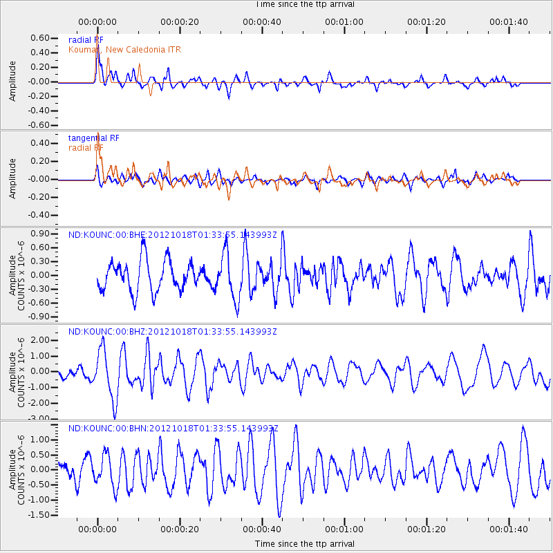
KOUNC Koumac, New Caledonia - Earthquake Result Viewer
*The percent match for this event was below the threshold and hence no stack was calculated.
| Earthquake location: |
West Of Macquarie Island |
| Earthquake latitude/longitude: |
-54.2/144.0 |
| Earthquake time(UTC): |
2012/10/18 (292) 01:27:16 GMT |
| Earthquake Depth: |
7.5 km |
| Earthquake Magnitude: |
5.6 MB, 5.8 MS, 5.9 MW, 5.9 MW |
| Earthquake Catalog/Contributor: |
WHDF/NEIC |
|
| Network: |
ND New CaleDonia Broadband Seismic Network |
| Station: |
KOUNC Koumac, New Caledonia |
| Lat/Lon: |
20.55 S/164.29 E |
| Elevation: |
88 m |
|
| Distance: |
37.0 deg |
| Az: |
32.671 deg |
| Baz: |
199.774 deg |
| Ray Param: |
$rayparam |
*The percent match for this event was below the threshold and hence was not used in the summary stack. |
|
| Radial Match: |
75.444534 % |
| Radial Bump: |
359 |
| Transverse Match: |
67.92229 % |
| Transverse Bump: |
400 |
| SOD ConfigId: |
478790 |
| Insert Time: |
2013-02-23 15:45:07.362 +0000 |
| GWidth: |
2.5 |
| Max Bumps: |
400 |
| Tol: |
0.001 |
|
Signal To Noise
| Channel | StoN | STA | LTA |
| ND:KOUNC:00:BHZ:20121018T01:33:55.143993Z | 8.093481 | 1.6140251E-6 | 1.9942286E-7 |
| ND:KOUNC:00:BHN:20121018T01:33:55.143993Z | 1.8213193 | 5.353166E-7 | 2.9391694E-7 |
| ND:KOUNC:00:BHE:20121018T01:33:55.143993Z | 1.5308806 | 5.0605405E-7 | 3.30564E-7 |
| Arrivals |
| Ps | |
| PpPs | |
| PsPs/PpSs | |


