You are here: Home > Network List > CI - Caltech Regional Seismic Network Stations List
> Station MPM Manuel Prospect Mine, California, USA > Earthquake Result Viewer
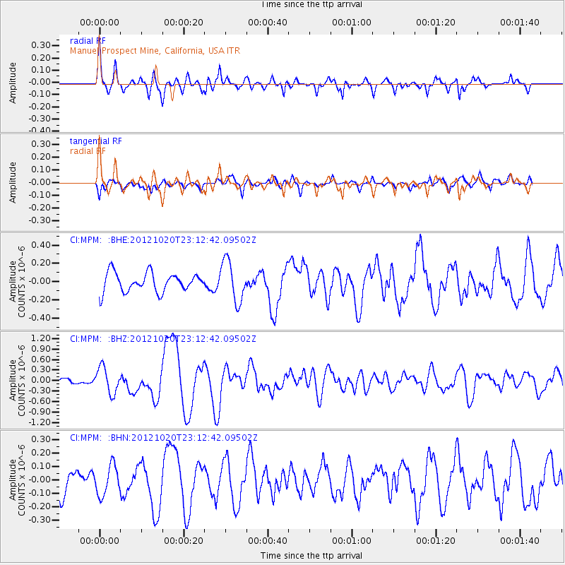
MPM Manuel Prospect Mine, California, USA - Earthquake Result Viewer
*The percent match for this event was below the threshold and hence no stack was calculated.
| Earthquake location: |
Vanuatu Islands |
| Earthquake latitude/longitude: |
-13.6/166.6 |
| Earthquake time(UTC): |
2012/10/20 (294) 23:00:32 GMT |
| Earthquake Depth: |
36 km |
| Earthquake Magnitude: |
5.9 MB, 6.1 MS, 6.2 MW, 6.2 MW |
| Earthquake Catalog/Contributor: |
WHDF/NEIC |
|
| Network: |
CI Caltech Regional Seismic Network |
| Station: |
MPM Manuel Prospect Mine, California, USA |
| Lat/Lon: |
36.06 N/117.49 W |
| Elevation: |
185 m |
|
| Distance: |
86.9 deg |
| Az: |
51.928 deg |
| Baz: |
250.88 deg |
| Ray Param: |
$rayparam |
*The percent match for this event was below the threshold and hence was not used in the summary stack. |
|
| Radial Match: |
79.668915 % |
| Radial Bump: |
400 |
| Transverse Match: |
56.19187 % |
| Transverse Bump: |
400 |
| SOD ConfigId: |
478790 |
| Insert Time: |
2013-02-23 15:58:53.302 +0000 |
| GWidth: |
2.5 |
| Max Bumps: |
400 |
| Tol: |
0.001 |
|
Signal To Noise
| Channel | StoN | STA | LTA |
| CI:MPM: :BHZ:20121020T23:12:42.09502Z | 5.0137496 | 3.780159E-7 | 7.539585E-8 |
| CI:MPM: :BHN:20121020T23:12:42.09502Z | 0.9586973 | 1.1362794E-7 | 1.18523275E-7 |
| CI:MPM: :BHE:20121020T23:12:42.09502Z | 2.2030349 | 2.2850055E-7 | 1.0372081E-7 |
| Arrivals |
| Ps | |
| PpPs | |
| PsPs/PpSs | |


