You are here: Home > Network List > TA - USArray Transportable Network (new EarthScope stations) Stations List
> Station O03E Paynes Creek, CA, USA > Earthquake Result Viewer
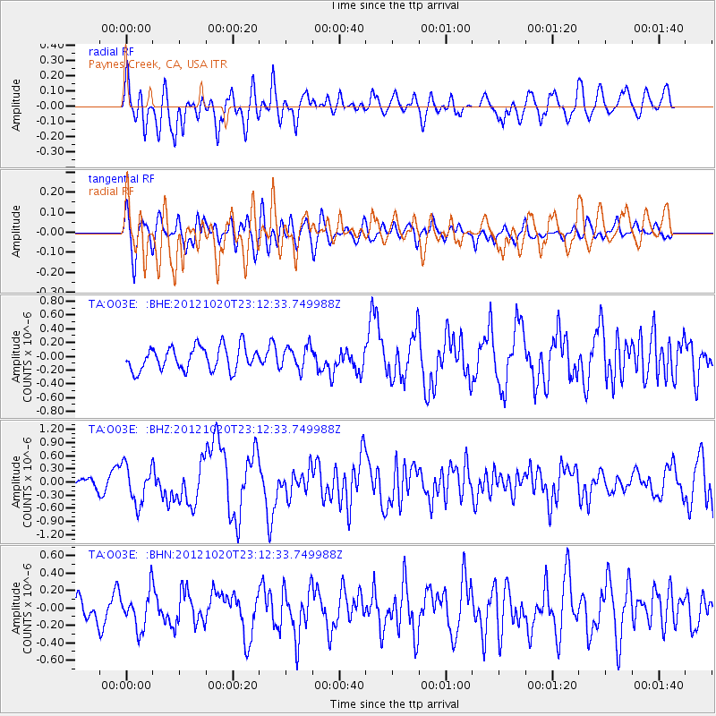
O03E Paynes Creek, CA, USA - Earthquake Result Viewer
*The percent match for this event was below the threshold and hence no stack was calculated.
| Earthquake location: |
Vanuatu Islands |
| Earthquake latitude/longitude: |
-13.6/166.6 |
| Earthquake time(UTC): |
2012/10/20 (294) 23:00:32 GMT |
| Earthquake Depth: |
36 km |
| Earthquake Magnitude: |
5.9 MB, 6.1 MS, 6.2 MW, 6.2 MW |
| Earthquake Catalog/Contributor: |
WHDF/NEIC |
|
| Network: |
TA USArray Transportable Network (new EarthScope stations) |
| Station: |
O03E Paynes Creek, CA, USA |
| Lat/Lon: |
40.29 N/121.80 W |
| Elevation: |
967 m |
|
| Distance: |
85.2 deg |
| Az: |
46.761 deg |
| Baz: |
247.862 deg |
| Ray Param: |
$rayparam |
*The percent match for this event was below the threshold and hence was not used in the summary stack. |
|
| Radial Match: |
76.8668 % |
| Radial Bump: |
400 |
| Transverse Match: |
54.341362 % |
| Transverse Bump: |
400 |
| SOD ConfigId: |
478790 |
| Insert Time: |
2013-02-23 16:08:23.620 +0000 |
| GWidth: |
2.5 |
| Max Bumps: |
400 |
| Tol: |
0.001 |
|
Signal To Noise
| Channel | StoN | STA | LTA |
| TA:O03E: :BHZ:20121020T23:12:33.749988Z | 4.219404 | 4.350189E-7 | 1.0309961E-7 |
| TA:O03E: :BHN:20121020T23:12:33.749988Z | 1.4636279 | 2.1618962E-7 | 1.4770804E-7 |
| TA:O03E: :BHE:20121020T23:12:33.749988Z | 0.9704584 | 1.6502582E-7 | 1.7004936E-7 |
| Arrivals |
| Ps | |
| PpPs | |
| PsPs/PpSs | |


