You are here: Home > Network List > G - GEOSCOPE Stations List
> Station TAM Tamanrasset, Algeria > Earthquake Result Viewer
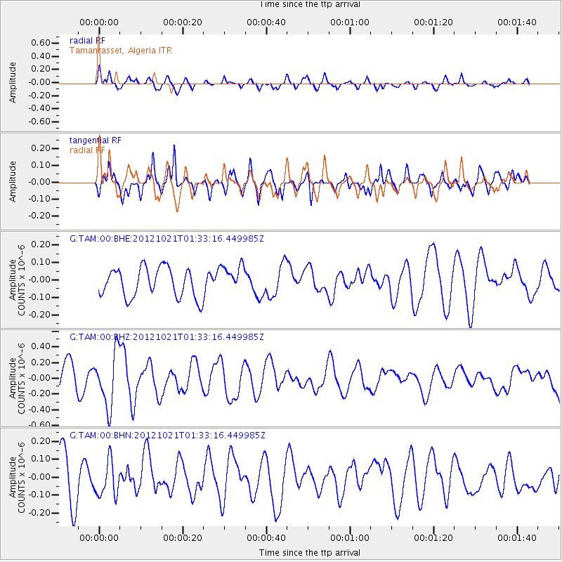
TAM Tamanrasset, Algeria - Earthquake Result Viewer
*The percent match for this event was below the threshold and hence no stack was calculated.
| Earthquake location: |
Iceland Region |
| Earthquake latitude/longitude: |
66.3/-18.7 |
| Earthquake time(UTC): |
2012/10/21 (295) 01:25:22 GMT |
| Earthquake Depth: |
10 km |
| Earthquake Magnitude: |
5.5 MW, 5.2 MS, 5.4 MB, 5.6 MW |
| Earthquake Catalog/Contributor: |
WHDF/NEIC |
|
| Network: |
G GEOSCOPE |
| Station: |
TAM Tamanrasset, Algeria |
| Lat/Lon: |
22.79 N/5.53 E |
| Elevation: |
1377 m |
|
| Distance: |
46.2 deg |
| Az: |
148.385 deg |
| Baz: |
346.731 deg |
| Ray Param: |
$rayparam |
*The percent match for this event was below the threshold and hence was not used in the summary stack. |
|
| Radial Match: |
63.65575 % |
| Radial Bump: |
400 |
| Transverse Match: |
72.06786 % |
| Transverse Bump: |
400 |
| SOD ConfigId: |
478790 |
| Insert Time: |
2013-02-25 03:32:16.091 +0000 |
| GWidth: |
2.5 |
| Max Bumps: |
400 |
| Tol: |
0.001 |
|
Signal To Noise
| Channel | StoN | STA | LTA |
| G:TAM:00:BHZ:20121021T01:33:16.449985Z | 2.4923136 | 3.554102E-7 | 1.4260253E-7 |
| G:TAM:00:BHN:20121021T01:33:16.449985Z | 0.9622063 | 9.8645955E-8 | 1.0252059E-7 |
| G:TAM:00:BHE:20121021T01:33:16.449985Z | 0.9805605 | 8.250027E-8 | 8.413583E-8 |
| Arrivals |
| Ps | |
| PpPs | |
| PsPs/PpSs | |


