You are here: Home > Network List > GT - Global Telemetered Seismograph Network (USAF/USGS) Stations List
> Station LPAZ La Paz , Bolivia > Earthquake Result Viewer
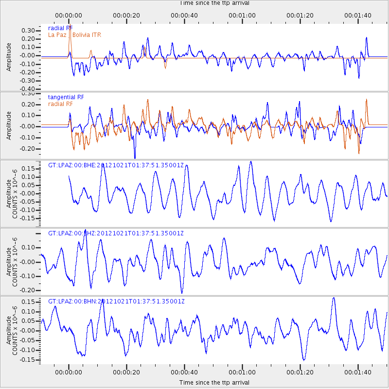
LPAZ La Paz , Bolivia - Earthquake Result Viewer
*The percent match for this event was below the threshold and hence no stack was calculated.
| Earthquake location: |
Iceland Region |
| Earthquake latitude/longitude: |
66.3/-18.7 |
| Earthquake time(UTC): |
2012/10/21 (295) 01:25:22 GMT |
| Earthquake Depth: |
10 km |
| Earthquake Magnitude: |
5.5 MW, 5.2 MS, 5.4 MB, 5.6 MW |
| Earthquake Catalog/Contributor: |
WHDF/NEIC |
|
| Network: |
GT Global Telemetered Seismograph Network (USAF/USGS) |
| Station: |
LPAZ La Paz , Bolivia |
| Lat/Lon: |
16.17 S/68.08 W |
| Elevation: |
4817 m |
|
| Distance: |
90.0 deg |
| Az: |
226.864 deg |
| Baz: |
17.87 deg |
| Ray Param: |
$rayparam |
*The percent match for this event was below the threshold and hence was not used in the summary stack. |
|
| Radial Match: |
56.819073 % |
| Radial Bump: |
400 |
| Transverse Match: |
44.112465 % |
| Transverse Bump: |
358 |
| SOD ConfigId: |
478790 |
| Insert Time: |
2013-02-25 03:32:55.112 +0000 |
| GWidth: |
2.5 |
| Max Bumps: |
400 |
| Tol: |
0.001 |
|
Signal To Noise
| Channel | StoN | STA | LTA |
| GT:LPAZ:00:BHZ:20121021T01:37:51.35001Z | 2.2973998 | 1.1029093E-7 | 4.800685E-8 |
| GT:LPAZ:00:BHN:20121021T01:37:51.35001Z | 1.1215769 | 6.592338E-8 | 5.8777403E-8 |
| GT:LPAZ:00:BHE:20121021T01:37:51.35001Z | 1.2205778 | 7.991264E-8 | 6.547115E-8 |
| Arrivals |
| Ps | |
| PpPs | |
| PsPs/PpSs | |


