You are here: Home > Network List > TA - USArray Transportable Network (new EarthScope stations) Stations List
> Station N23A Red Feather Lakes, CO, USA > Earthquake Result Viewer
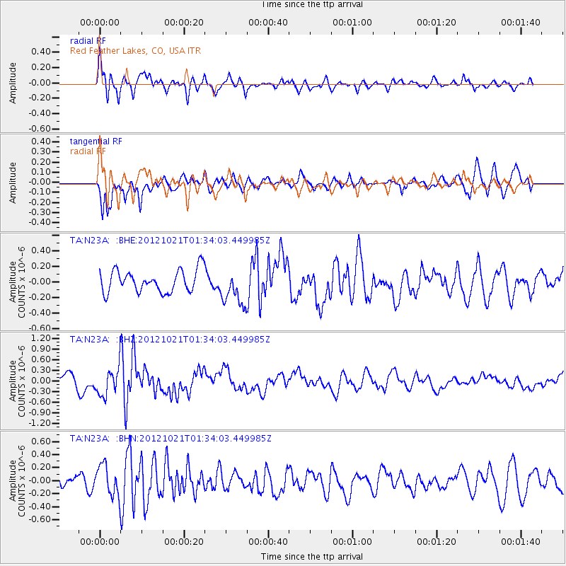
N23A Red Feather Lakes, CO, USA - Earthquake Result Viewer
*The percent match for this event was below the threshold and hence no stack was calculated.
| Earthquake location: |
Iceland Region |
| Earthquake latitude/longitude: |
66.3/-18.7 |
| Earthquake time(UTC): |
2012/10/21 (295) 01:25:22 GMT |
| Earthquake Depth: |
10 km |
| Earthquake Magnitude: |
5.5 MW, 5.2 MS, 5.4 MB, 5.6 MW |
| Earthquake Catalog/Contributor: |
WHDF/NEIC |
|
| Network: |
TA USArray Transportable Network (new EarthScope stations) |
| Station: |
N23A Red Feather Lakes, CO, USA |
| Lat/Lon: |
40.89 N/105.94 W |
| Elevation: |
2458 m |
|
| Distance: |
52.3 deg |
| Az: |
286.936 deg |
| Baz: |
30.657 deg |
| Ray Param: |
$rayparam |
*The percent match for this event was below the threshold and hence was not used in the summary stack. |
|
| Radial Match: |
74.49598 % |
| Radial Bump: |
400 |
| Transverse Match: |
61.0283 % |
| Transverse Bump: |
384 |
| SOD ConfigId: |
478790 |
| Insert Time: |
2013-02-25 03:37:55.243 +0000 |
| GWidth: |
2.5 |
| Max Bumps: |
400 |
| Tol: |
0.001 |
|
Signal To Noise
| Channel | StoN | STA | LTA |
| TA:N23A: :BHZ:20121021T01:34:03.449985Z | 2.3971376 | 4.0007123E-7 | 1.668954E-7 |
| TA:N23A: :BHN:20121021T01:34:03.449985Z | 1.6315843 | 2.436151E-7 | 1.4931199E-7 |
| TA:N23A: :BHE:20121021T01:34:03.449985Z | 1.6716843 | 2.3535934E-7 | 1.4079174E-7 |
| Arrivals |
| Ps | |
| PpPs | |
| PsPs/PpSs | |


