You are here: Home > Network List > TA - USArray Transportable Network (new EarthScope stations) Stations List
> Station P42A Winchester, IL, USA > Earthquake Result Viewer
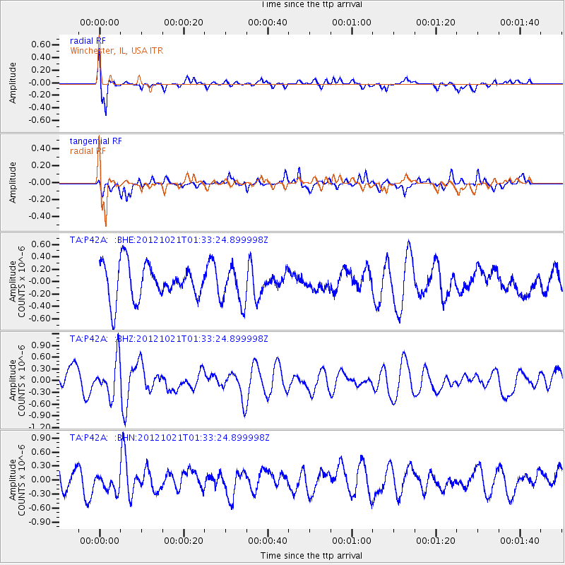
P42A Winchester, IL, USA - Earthquake Result Viewer
*The percent match for this event was below the threshold and hence no stack was calculated.
| Earthquake location: |
Iceland Region |
| Earthquake latitude/longitude: |
66.3/-18.7 |
| Earthquake time(UTC): |
2012/10/21 (295) 01:25:22 GMT |
| Earthquake Depth: |
10 km |
| Earthquake Magnitude: |
5.5 MW, 5.2 MS, 5.4 MB, 5.6 MW |
| Earthquake Catalog/Contributor: |
WHDF/NEIC |
|
| Network: |
TA USArray Transportable Network (new EarthScope stations) |
| Station: |
P42A Winchester, IL, USA |
| Lat/Lon: |
39.59 N/90.34 W |
| Elevation: |
197 m |
|
| Distance: |
47.3 deg |
| Az: |
272.673 deg |
| Baz: |
31.488 deg |
| Ray Param: |
$rayparam |
*The percent match for this event was below the threshold and hence was not used in the summary stack. |
|
| Radial Match: |
69.16958 % |
| Radial Bump: |
400 |
| Transverse Match: |
51.316547 % |
| Transverse Bump: |
276 |
| SOD ConfigId: |
478790 |
| Insert Time: |
2013-02-25 03:44:23.438 +0000 |
| GWidth: |
2.5 |
| Max Bumps: |
400 |
| Tol: |
0.001 |
|
Signal To Noise
| Channel | StoN | STA | LTA |
| TA:P42A: :BHZ:20121021T01:33:24.899998Z | 1.9109796 | 4.7890364E-7 | 2.5060635E-7 |
| TA:P42A: :BHN:20121021T01:33:24.899998Z | 0.7719758 | 1.8754858E-7 | 2.429462E-7 |
| TA:P42A: :BHE:20121021T01:33:24.899998Z | 1.0506102 | 2.9843605E-7 | 2.8405975E-7 |
| Arrivals |
| Ps | |
| PpPs | |
| PsPs/PpSs | |


