You are here: Home > Network List > TA - USArray Transportable Network (new EarthScope stations) Stations List
> Station U53A Fall Branch, TN, USA > Earthquake Result Viewer
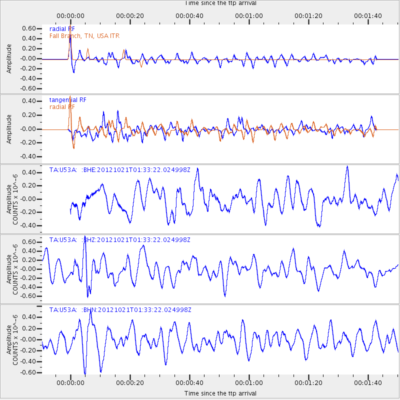
U53A Fall Branch, TN, USA - Earthquake Result Viewer
*The percent match for this event was below the threshold and hence no stack was calculated.
| Earthquake location: |
Iceland Region |
| Earthquake latitude/longitude: |
66.3/-18.7 |
| Earthquake time(UTC): |
2012/10/21 (295) 01:25:22 GMT |
| Earthquake Depth: |
10 km |
| Earthquake Magnitude: |
5.5 MW, 5.2 MS, 5.4 MB, 5.6 MW |
| Earthquake Catalog/Contributor: |
WHDF/NEIC |
|
| Network: |
TA USArray Transportable Network (new EarthScope stations) |
| Station: |
U53A Fall Branch, TN, USA |
| Lat/Lon: |
36.36 N/82.58 W |
| Elevation: |
559 m |
|
| Distance: |
46.9 deg |
| Az: |
263.222 deg |
| Baz: |
29.809 deg |
| Ray Param: |
$rayparam |
*The percent match for this event was below the threshold and hence was not used in the summary stack. |
|
| Radial Match: |
54.639904 % |
| Radial Bump: |
400 |
| Transverse Match: |
69.91765 % |
| Transverse Bump: |
388 |
| SOD ConfigId: |
478790 |
| Insert Time: |
2013-02-25 03:52:48.855 +0000 |
| GWidth: |
2.5 |
| Max Bumps: |
400 |
| Tol: |
0.001 |
|
Signal To Noise
| Channel | StoN | STA | LTA |
| TA:U53A: :BHZ:20121021T01:33:22.024998Z | 1.3646234 | 2.4859654E-7 | 1.8217226E-7 |
| TA:U53A: :BHN:20121021T01:33:22.024998Z | 1.8932977 | 2.4710633E-7 | 1.3051637E-7 |
| TA:U53A: :BHE:20121021T01:33:22.024998Z | 1.2903283 | 1.990991E-7 | 1.5430113E-7 |
| Arrivals |
| Ps | |
| PpPs | |
| PsPs/PpSs | |


