You are here: Home > Network List > TA - USArray Transportable Network (new EarthScope stations) Stations List
> Station R49A Shelbyville, KY, USA > Earthquake Result Viewer
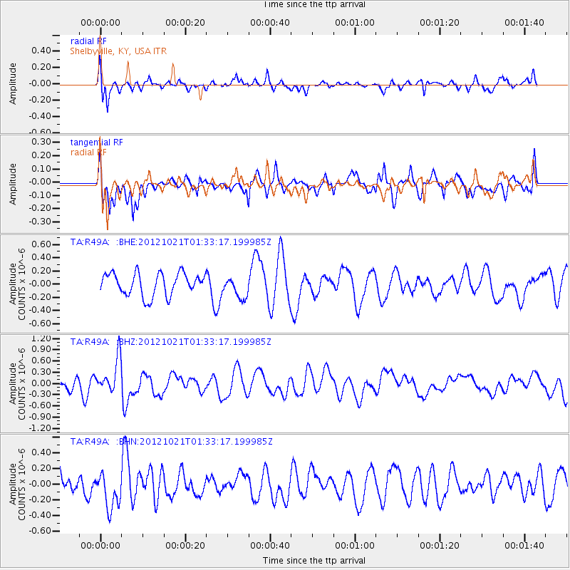
R49A Shelbyville, KY, USA - Earthquake Result Viewer
*The percent match for this event was below the threshold and hence no stack was calculated.
| Earthquake location: |
Iceland Region |
| Earthquake latitude/longitude: |
66.3/-18.7 |
| Earthquake time(UTC): |
2012/10/21 (295) 01:25:22 GMT |
| Earthquake Depth: |
10 km |
| Earthquake Magnitude: |
5.5 MW, 5.2 MS, 5.4 MB, 5.6 MW |
| Earthquake Catalog/Contributor: |
WHDF/NEIC |
|
| Network: |
TA USArray Transportable Network (new EarthScope stations) |
| Station: |
R49A Shelbyville, KY, USA |
| Lat/Lon: |
38.29 N/85.17 W |
| Elevation: |
251 m |
|
| Distance: |
46.3 deg |
| Az: |
267.017 deg |
| Baz: |
30.851 deg |
| Ray Param: |
$rayparam |
*The percent match for this event was below the threshold and hence was not used in the summary stack. |
|
| Radial Match: |
60.876816 % |
| Radial Bump: |
400 |
| Transverse Match: |
60.948154 % |
| Transverse Bump: |
400 |
| SOD ConfigId: |
478790 |
| Insert Time: |
2013-02-25 03:53:23.216 +0000 |
| GWidth: |
2.5 |
| Max Bumps: |
400 |
| Tol: |
0.001 |
|
Signal To Noise
| Channel | StoN | STA | LTA |
| TA:R49A: :BHZ:20121021T01:33:17.199985Z | 2.4301023 | 4.6566595E-7 | 1.91624E-7 |
| TA:R49A: :BHN:20121021T01:33:17.199985Z | 1.6274092 | 2.384444E-7 | 1.4651778E-7 |
| TA:R49A: :BHE:20121021T01:33:17.199985Z | 0.97850096 | 1.6578817E-7 | 1.6943075E-7 |
| Arrivals |
| Ps | |
| PpPs | |
| PsPs/PpSs | |


