You are here: Home > Network List > AZ - ANZA Regional Network Stations List
> Station SMER AZ.SMER > Earthquake Result Viewer
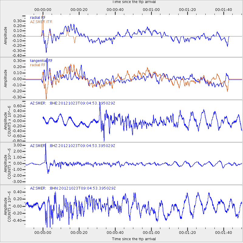
SMER AZ.SMER - Earthquake Result Viewer
*The percent match for this event was below the threshold and hence no stack was calculated.
| Earthquake location: |
Southeast Of Honshu, Japan |
| Earthquake latitude/longitude: |
29.1/139.3 |
| Earthquake time(UTC): |
2012/10/23 (297) 08:53:38 GMT |
| Earthquake Depth: |
436 km |
| Earthquake Magnitude: |
6.0 MB, 5.9 MW, 6.0 MW |
| Earthquake Catalog/Contributor: |
WHDF/NEIC |
|
| Network: |
AZ ANZA Regional Network |
| Station: |
SMER AZ.SMER |
| Lat/Lon: |
33.46 N/117.17 W |
| Elevation: |
355 m |
|
| Distance: |
84.6 deg |
| Az: |
54.705 deg |
| Baz: |
301.265 deg |
| Ray Param: |
$rayparam |
*The percent match for this event was below the threshold and hence was not used in the summary stack. |
|
| Radial Match: |
64.74048 % |
| Radial Bump: |
400 |
| Transverse Match: |
65.85515 % |
| Transverse Bump: |
400 |
| SOD ConfigId: |
478790 |
| Insert Time: |
2013-02-25 04:07:46.103 +0000 |
| GWidth: |
2.5 |
| Max Bumps: |
400 |
| Tol: |
0.001 |
|
Signal To Noise
| Channel | StoN | STA | LTA |
| AZ:SMER: :BHZ:20121023T09:04:53.395029Z | 6.827609 | 9.1704885E-7 | 1.3431479E-7 |
| AZ:SMER: :BHN:20121023T09:04:53.395029Z | 2.3451147 | 2.3062387E-7 | 9.8342255E-8 |
| AZ:SMER: :BHE:20121023T09:04:53.395029Z | 2.231707 | 2.9422574E-7 | 1.3183887E-7 |
| Arrivals |
| Ps | |
| PpPs | |
| PsPs/PpSs | |


