You are here: Home > Network List > CI - Caltech Regional Seismic Network Stations List
> Station MPM Manuel Prospect Mine, California, USA > Earthquake Result Viewer
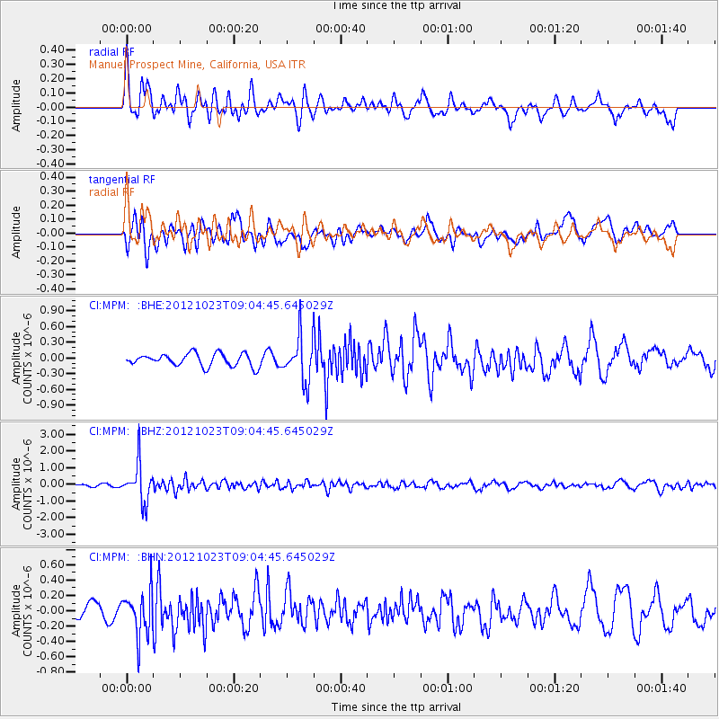
MPM Manuel Prospect Mine, California, USA - Earthquake Result Viewer
*The percent match for this event was below the threshold and hence no stack was calculated.
| Earthquake location: |
Southeast Of Honshu, Japan |
| Earthquake latitude/longitude: |
29.1/139.3 |
| Earthquake time(UTC): |
2012/10/23 (297) 08:53:38 GMT |
| Earthquake Depth: |
436 km |
| Earthquake Magnitude: |
6.0 MB, 5.9 MW, 6.0 MW |
| Earthquake Catalog/Contributor: |
WHDF/NEIC |
|
| Network: |
CI Caltech Regional Seismic Network |
| Station: |
MPM Manuel Prospect Mine, California, USA |
| Lat/Lon: |
36.06 N/117.49 W |
| Elevation: |
185 m |
|
| Distance: |
83.1 deg |
| Az: |
52.606 deg |
| Baz: |
300.86 deg |
| Ray Param: |
$rayparam |
*The percent match for this event was below the threshold and hence was not used in the summary stack. |
|
| Radial Match: |
63.35789 % |
| Radial Bump: |
400 |
| Transverse Match: |
68.07012 % |
| Transverse Bump: |
400 |
| SOD ConfigId: |
478790 |
| Insert Time: |
2013-02-25 04:14:26.634 +0000 |
| GWidth: |
2.5 |
| Max Bumps: |
400 |
| Tol: |
0.001 |
|
Signal To Noise
| Channel | StoN | STA | LTA |
| CI:MPM: :BHZ:20121023T09:04:45.645029Z | 8.636714 | 1.1673097E-6 | 1.351567E-7 |
| CI:MPM: :BHN:20121023T09:04:45.645029Z | 3.2099562 | 2.966343E-7 | 9.24107E-8 |
| CI:MPM: :BHE:20121023T09:04:45.645029Z | 3.5695398 | 4.3228965E-7 | 1.2110515E-7 |
| Arrivals |
| Ps | |
| PpPs | |
| PsPs/PpSs | |


