You are here: Home > Network List > CI - Caltech Regional Seismic Network Stations List
> Station SMM Simmler, CA, USA > Earthquake Result Viewer
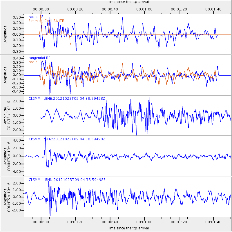
SMM Simmler, CA, USA - Earthquake Result Viewer
*The percent match for this event was below the threshold and hence no stack was calculated.
| Earthquake location: |
Southeast Of Honshu, Japan |
| Earthquake latitude/longitude: |
29.1/139.3 |
| Earthquake time(UTC): |
2012/10/23 (297) 08:53:38 GMT |
| Earthquake Depth: |
436 km |
| Earthquake Magnitude: |
6.0 MB, 5.9 MW, 6.0 MW |
| Earthquake Catalog/Contributor: |
WHDF/NEIC |
|
| Network: |
CI Caltech Regional Seismic Network |
| Station: |
SMM Simmler, CA, USA |
| Lat/Lon: |
35.31 N/120.00 W |
| Elevation: |
599 m |
|
| Distance: |
81.7 deg |
| Az: |
54.29 deg |
| Baz: |
299.627 deg |
| Ray Param: |
$rayparam |
*The percent match for this event was below the threshold and hence was not used in the summary stack. |
|
| Radial Match: |
69.17335 % |
| Radial Bump: |
400 |
| Transverse Match: |
76.93162 % |
| Transverse Bump: |
400 |
| SOD ConfigId: |
478790 |
| Insert Time: |
2013-02-25 14:07:14.066 +0000 |
| GWidth: |
2.5 |
| Max Bumps: |
400 |
| Tol: |
0.001 |
|
Signal To Noise
| Channel | StoN | STA | LTA |
| CI:SMM: :BHZ:20121023T09:04:38.59498Z | 7.1058726 | 1.7843752E-6 | 2.5111274E-7 |
| CI:SMM: :BHN:20121023T09:04:38.59498Z | 2.0168757 | 6.9486555E-7 | 3.4452572E-7 |
| CI:SMM: :BHE:20121023T09:04:38.59498Z | 0.9690826 | 4.2290216E-7 | 4.3639434E-7 |
| Arrivals |
| Ps | |
| PpPs | |
| PsPs/PpSs | |


