You are here: Home > Network List > IW - Intermountain West Stations List
> Station MOOW Moose Ponds, Wyoming, USA > Earthquake Result Viewer
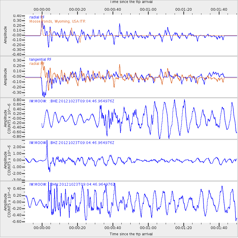
MOOW Moose Ponds, Wyoming, USA - Earthquake Result Viewer
*The percent match for this event was below the threshold and hence no stack was calculated.
| Earthquake location: |
Southeast Of Honshu, Japan |
| Earthquake latitude/longitude: |
29.1/139.3 |
| Earthquake time(UTC): |
2012/10/23 (297) 08:53:38 GMT |
| Earthquake Depth: |
436 km |
| Earthquake Magnitude: |
6.0 MB, 5.9 MW, 6.0 MW |
| Earthquake Catalog/Contributor: |
WHDF/NEIC |
|
| Network: |
IW Intermountain West |
| Station: |
MOOW Moose Ponds, Wyoming, USA |
| Lat/Lon: |
43.75 N/110.74 W |
| Elevation: |
2128 m |
|
| Distance: |
83.3 deg |
| Az: |
43.282 deg |
| Baz: |
304.078 deg |
| Ray Param: |
$rayparam |
*The percent match for this event was below the threshold and hence was not used in the summary stack. |
|
| Radial Match: |
71.25253 % |
| Radial Bump: |
398 |
| Transverse Match: |
75.13064 % |
| Transverse Bump: |
400 |
| SOD ConfigId: |
478790 |
| Insert Time: |
2013-02-25 14:13:36.370 +0000 |
| GWidth: |
2.5 |
| Max Bumps: |
400 |
| Tol: |
0.001 |
|
Signal To Noise
| Channel | StoN | STA | LTA |
| IW:MOOW: :BHZ:20121023T09:04:46.964976Z | 5.7718034 | 9.296224E-7 | 1.6106273E-7 |
| IW:MOOW: :BHN:20121023T09:04:46.964976Z | 0.71230644 | 1.869375E-7 | 2.624397E-7 |
| IW:MOOW: :BHE:20121023T09:04:46.964976Z | 1.499419 | 2.799626E-7 | 1.8671406E-7 |
| Arrivals |
| Ps | |
| PpPs | |
| PsPs/PpSs | |


