You are here: Home > Network List > UW - Pacific Northwest Regional Seismic Network Stations List
> Station UMAT Pilot Rock, OR, USA > Earthquake Result Viewer
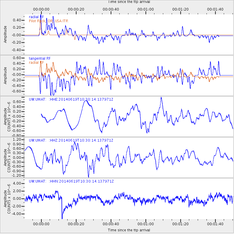
UMAT Pilot Rock, OR, USA - Earthquake Result Viewer
*The percent match for this event was below the threshold and hence no stack was calculated.
| Earthquake location: |
Vanuatu Islands |
| Earthquake latitude/longitude: |
-13.6/166.8 |
| Earthquake time(UTC): |
2014/06/19 (170) 10:17:58 GMT |
| Earthquake Depth: |
60 km |
| Earthquake Magnitude: |
6.4 MWP |
| Earthquake Catalog/Contributor: |
NEIC PDE/NEIC COMCAT |
|
| Network: |
UW Pacific Northwest Regional Seismic Network |
| Station: |
UMAT Pilot Rock, OR, USA |
| Lat/Lon: |
45.29 N/118.96 W |
| Elevation: |
1318 m |
|
| Distance: |
88.8 deg |
| Az: |
42.799 deg |
| Baz: |
249.383 deg |
| Ray Param: |
$rayparam |
*The percent match for this event was below the threshold and hence was not used in the summary stack. |
|
| Radial Match: |
75.979614 % |
| Radial Bump: |
400 |
| Transverse Match: |
57.611656 % |
| Transverse Bump: |
400 |
| SOD ConfigId: |
3390531 |
| Insert Time: |
2019-04-12 08:31:58.767 +0000 |
| GWidth: |
2.5 |
| Max Bumps: |
400 |
| Tol: |
0.001 |
|
Signal To Noise
| Channel | StoN | STA | LTA |
| UW:UMAT: :HHZ:20140619T10:30:14.137971Z | 1.2521197 | 4.691698E-7 | 3.7470048E-7 |
| UW:UMAT: :HHN:20140619T10:30:14.137971Z | 1.4864641 | 8.345049E-7 | 5.614026E-7 |
| UW:UMAT: :HHE:20140619T10:30:14.137971Z | 1.1410193 | 3.305405E-7 | 2.8968878E-7 |
| Arrivals |
| Ps | |
| PpPs | |
| PsPs/PpSs | |


